More photos from this trip: https://www.flickr.com/photos/jack_1962/albums/72157675877697576
Blog in Polish/po polsku: http://ontario-nature-polish.blogspot.ca/2016/10/biwakowanie-w-parku-long-point.html
The second half of May is a perfect time to commence the
camping season—the bugs have not arrived yet, children are still in school and
the weather is quite nice, at least during the day. As I mentioned in my other
blog, in 2013 we went camping to Algonquin Park at the end of May and had to
cut our trip short due to swarms of black flies (and mosquitoes). Thus, in
order to avoid those horrible insects, we decided to go South, not North, in
May—where black flies were not present.
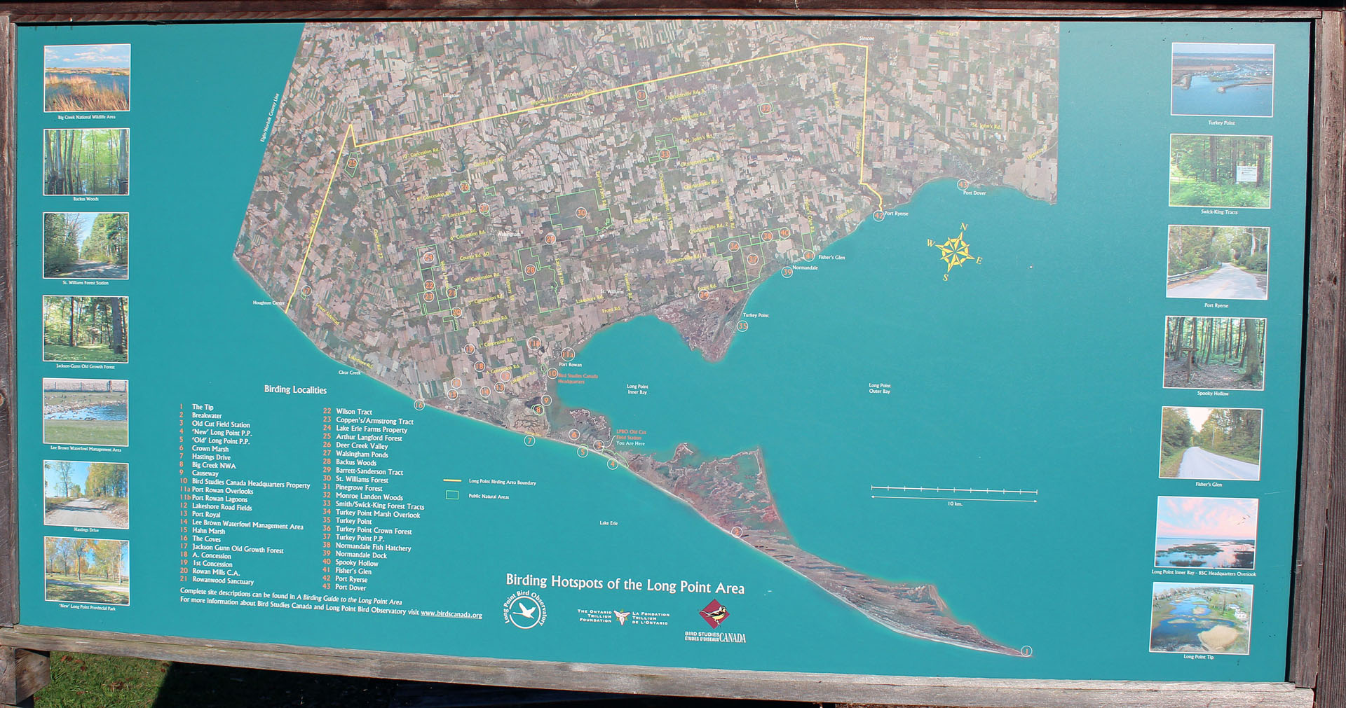 |
| Long Point |
It was our second visit in this Park in as many years and we
even managed to stay on the same campsite we had bivouacked the previous year
(Monarch Campground). We left on Sunday, May 15, 2016, one week before the
Victoria Day long weekend. The first two days were cold (probably below
freezing at night), windy and rainy (well, the day we left Toronto, it was
actually… snowing!), but we still had a wonderful time—our 4 sleeping bags
certainly came in very handy. Besides, soon the weather improved and it was
almost hot the day we were leaving.
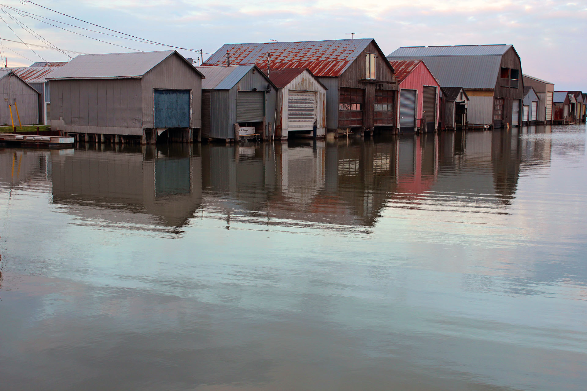 |
| Boathouses |
In fact, the first evening it was so cold, windy and cloudy,
that Catherine, afraid it might rain, decided to skip cooking at the campfire
and headed to the Boathouse Restaurant in Port Rowan. In front of the
restaurant I took numerous photos of the row of —what else?—boat houses—it was
a picture-perfect view! The meal of fish & chips and bread pudding also hit
the spot at this delightful eatery.
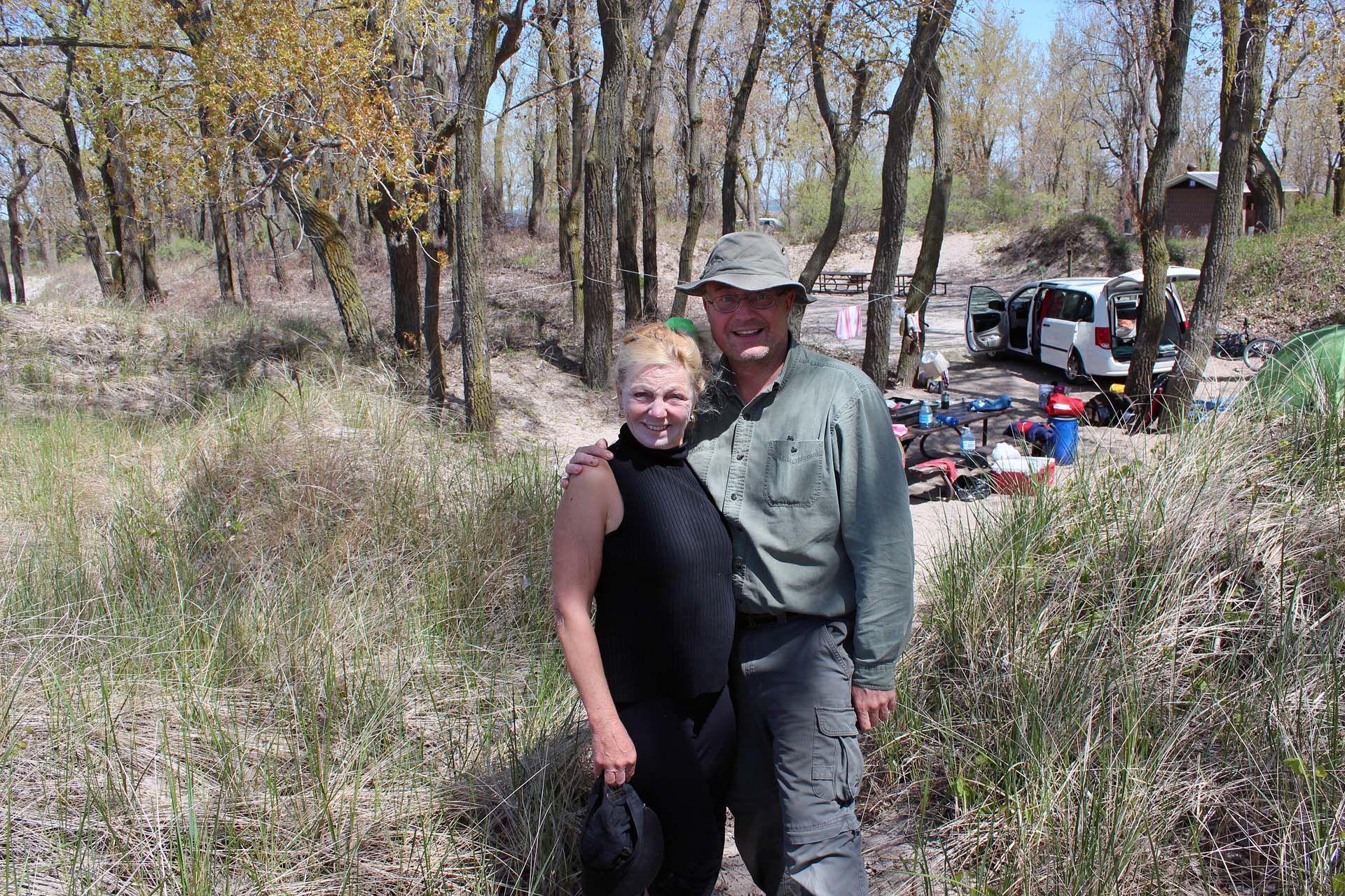 |
| Our campsite in Long Point Provincial Park |
The campsite, located in a sandy hollow close to the shores
of Lake Erie, was very nice and private—and the site across was vacant. There
were plenty of poison ivy around the campsite, so we had to exercise caution,
especially at night. There were some RVs at the park, most of them on Firefly
Campground (which was very open, with little shade) and on bigger campsites
farther from the lake and closer to the road. The beach was quite wide and
long. The park’s occupancy rate was quite low, but according to the online Park
Reservation System, there was not going to be a single vacant campsite over the
upcoming long weekend! We hardly saw any mosquitos—but after sun tanning in the
dunes Catherine realized there were plenty of ticks all over her and one had to
be removed with a tweezers. Since ticks are carried of Lyme disease, from then
on we were very careful to avoid any areas where ticks could be present. We
spotted a lot of various birds at our campsite; one of them, a very friendly
and inquisitive red winged blackbird, hung around our site all the time—it had
a very distinct shiny silver band on one of its legs, no doubt a souvenir of
his involuntary stopover at the nearby Bird Observatory! At night we could see
from the campsite city lights on the other side of Lake Erie, in the USA—as
well as from time to time I could spot a big freighter traversing the lake.
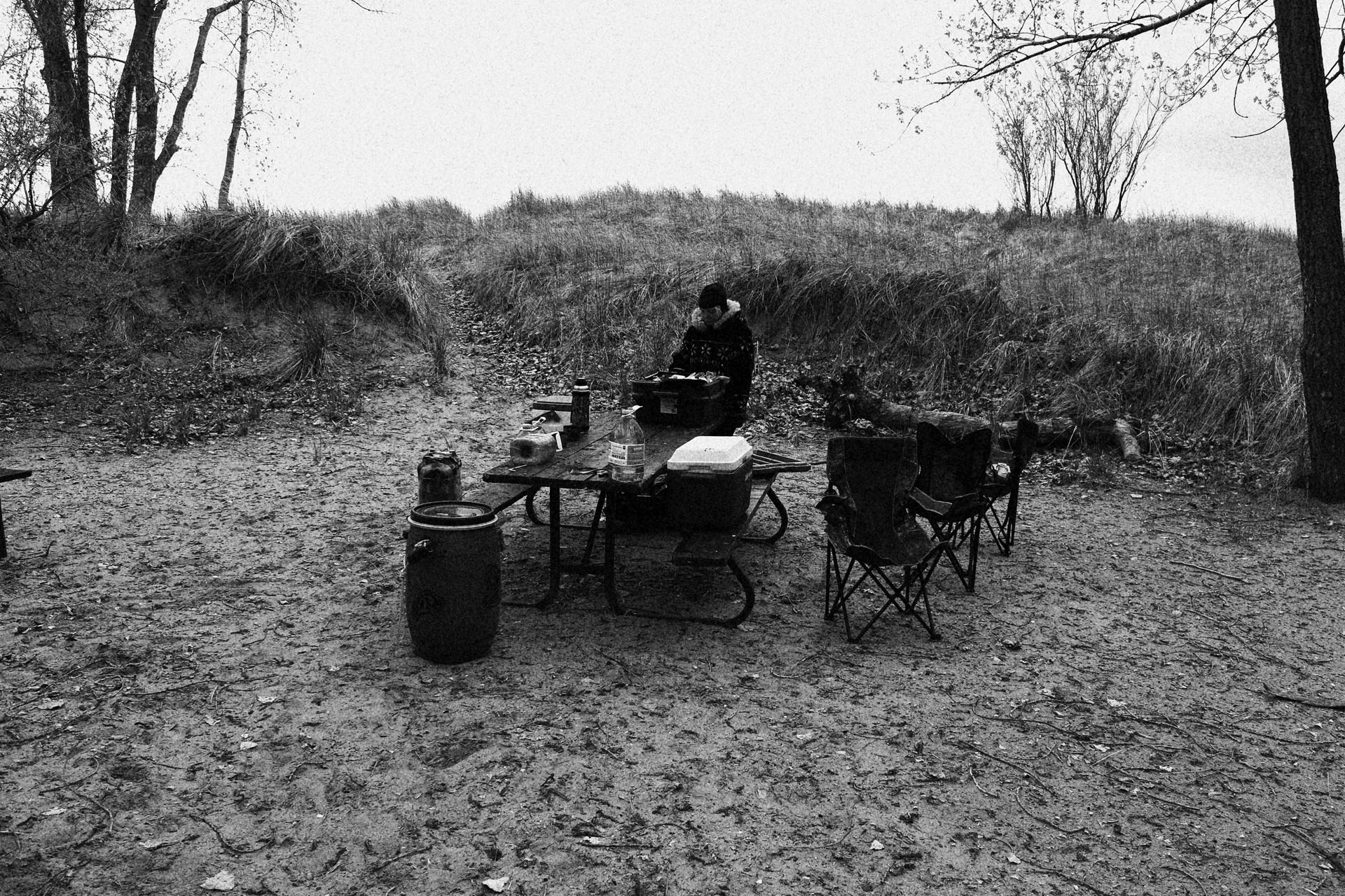 |
| It was cold! |
We also rode our bikes to the ‘old’ section of the park, Cottonwood
Campground (which was still closed), and it had a number of first-come,
first-served campsites. Some sites at Cottonwood were nice, but too close to
the road and not as cozy at the ones at Monarch. The separate day use area had
huge dues and picnic areas.
Although we were quite busy with our activities, I still
managed to finish reading one book, “The Courtyard”. Its author, Arkady Lvov,
smuggled it from the Soviet Union in a shoe-shine kit. The book dealt with the
lives of the residents of an apartment building in Odessa from 1936 to 1953.
Readers had an opportunity to closely observe their everyday struggle under
communism and their dealing with the absurdities of communal living and daily
repressions, albeit some trivial, of the Stalinist system. Although almost 700
pages long and at times somehow boring, overall I enjoyed this epic work as it
gave me a unique and humorous insight into the lives of individuals
representing various sections of Soviet society, who shared the same apartment
building.
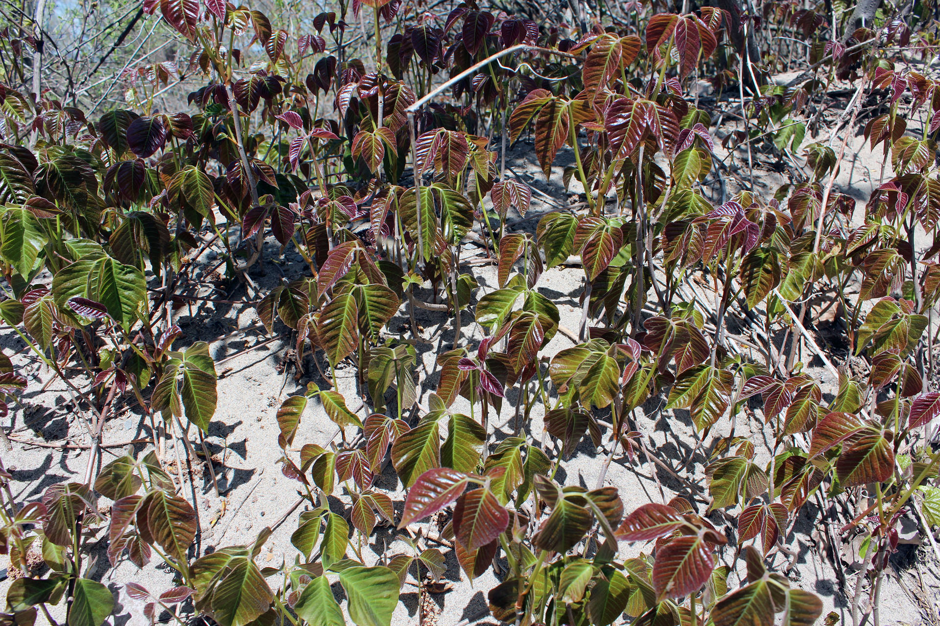 |
| Poison Ivy at campsites |
Long Point is the world’s longest freshwater sand spit,
about 40 km long and about 1 km across at its widest point. The Point’s sand
dune system is constantly shifting. It is also home to various wildlife and
plants. Several hundred years ago there was a portage here and a historical
plaque located just before the entrance summarized its history:
Long Point
Portage
This
portage, which crossed the isthmus joining Long Point to the mainland, was used
by travelers in small craft following the north shore of Lake Erie in order to
avoid the open waters and the length of the journey around the Point. Although
used earlier by the Indians, the portage was first recorded in 1670 by two
Sulpician missionaries, Dollier de Casson and René de Bréhant de Galinée. For
about 150 years traffic increased over the carrying place, first as a result of
the French expansion to the southwest, including the founding of Detroit in
1701, and, after 1783, because of the movement of settlers into this region.
The portage was abandoned in 1833 when a storm broke a navigable channel
through the isthmus.
The shallow waters and shifting shorelines around Long Point
claimed a lot of victims in the early 1800s, and wrecks were frequent. In 1828
deliberations on a proposed channel at the base of Long Point to create a safer
route for the ship traffic. In November, 1833 a big storm washed a cut 400
meters wide and 4 meters deep across the base of the Point and the government
of Canada kept maintaining it. Storms changed the channels’ characteristics
over the years from the width of a ship and 1.5 meters deep to nearly a
kilometer width and 7 m deep. In 1879 a wooden lighthouse was built to guide
ships to the tricky channel. Some storms closed one cut and opened another, so
ships, seeking shelter from open lake storms, often had a hard time finding
their way. No wonder that many ships ran aground around Long Point.
Furthermore, during the mid 19th century, that area became a center
for land-based piracy, called ‘blackbirding’.
Local residents, called ‘blackbirders’, erected fake lighthouses during times
of low visibility. Ships trying to enter the old cut would run aground. When
the crew abandoned ship, the blackbirders
would loot the ship of cargo and other valuables.
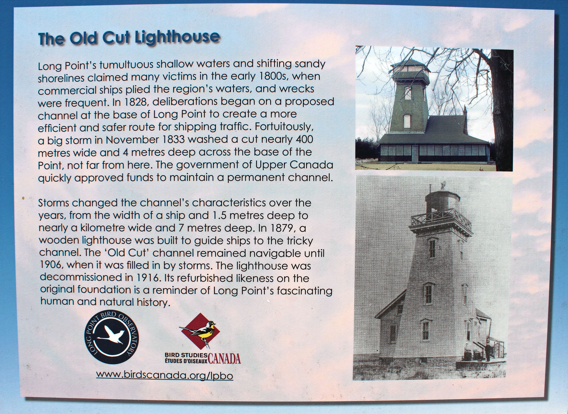 |
| The Old Cut Lighthouse |
Fortunately, not all locals were so callous. Abigail Becker (1830–1905),
also known as the Angel of Long Point, saved the lives of numerous sailors
caught in storms along the shores of Long Point. In November, 1854, she spotted
an overturned rowboat and immediately realized there must have been a shipwreck
nearby. Six sailors managed to reach the Old Cut lighthouse (the lighthouse keeper
already gone for the winter) and they were nursed back to health by Abigail.
Not long afterwards, on November 23rd, 1854, the schooner
“Conductor” was caught in blinding snow squalls and captain Henry Hackett
decided to change the course and head towards the safety of Old Cut.
Unfortunately, finding the cut in such a weather was almost impossible and soon
the schooner ran aground. As it was stuck in a shallow sandbar, 200 meters from
shore, it was mercilessly pounded by the waves and torn apart as 8 men clinging
to the rigging. After spotting the wreck, Abigail got her children and rushed
to beach opposite the wreck, where she started a huge fire, thus encouraging
the men to swim to the shore—the only viable chance they had to survive. And so
they did, with her help, reach the shore—she waded into the water to drag the
men to the shore, where the blessed fire and hot tea that was waiting for them!
There is a historical plaque in Port Rowan dedicated to Abigail Becker:
The Heroine of
Long Point
In November,
1854, the schooner "Conductor" was wrecked off this shore during one
of Lake Erie's many violent storms. Jeremiah Becker, who resided nearby, was
away on the mainland but his courageous wife, Abigail, risked her life by
repeatedly entering the water while assisting the exhausted seamen to reach
land. The eight sailors were housed and fed in her cabin until they recovered
from their ordeal. In recognition of her heroism she received a letter of
commendation from Queen Victoria, several financial awards, and a gold medal
from the Life Saving Benevolent Association of New York.
The “Old Cut” channel remained navigable until 1906, when it
was filled in by storms, thus ending Long Point’s brief history as an island.
The lighthouse was decommissioned in 1916. Its refurbished likeness on the
original foundation is a remainder of Long Point’s fascinating human and
natural history—as well as for those not familiar with Long Point’s history, it
looks out of place. (Sources: Bird Studies’ information plate, “Wikipedia” and
“Lake Erie Stories: Struggle and Survival on a Freshwater Ocean” by Chad
Fraser).
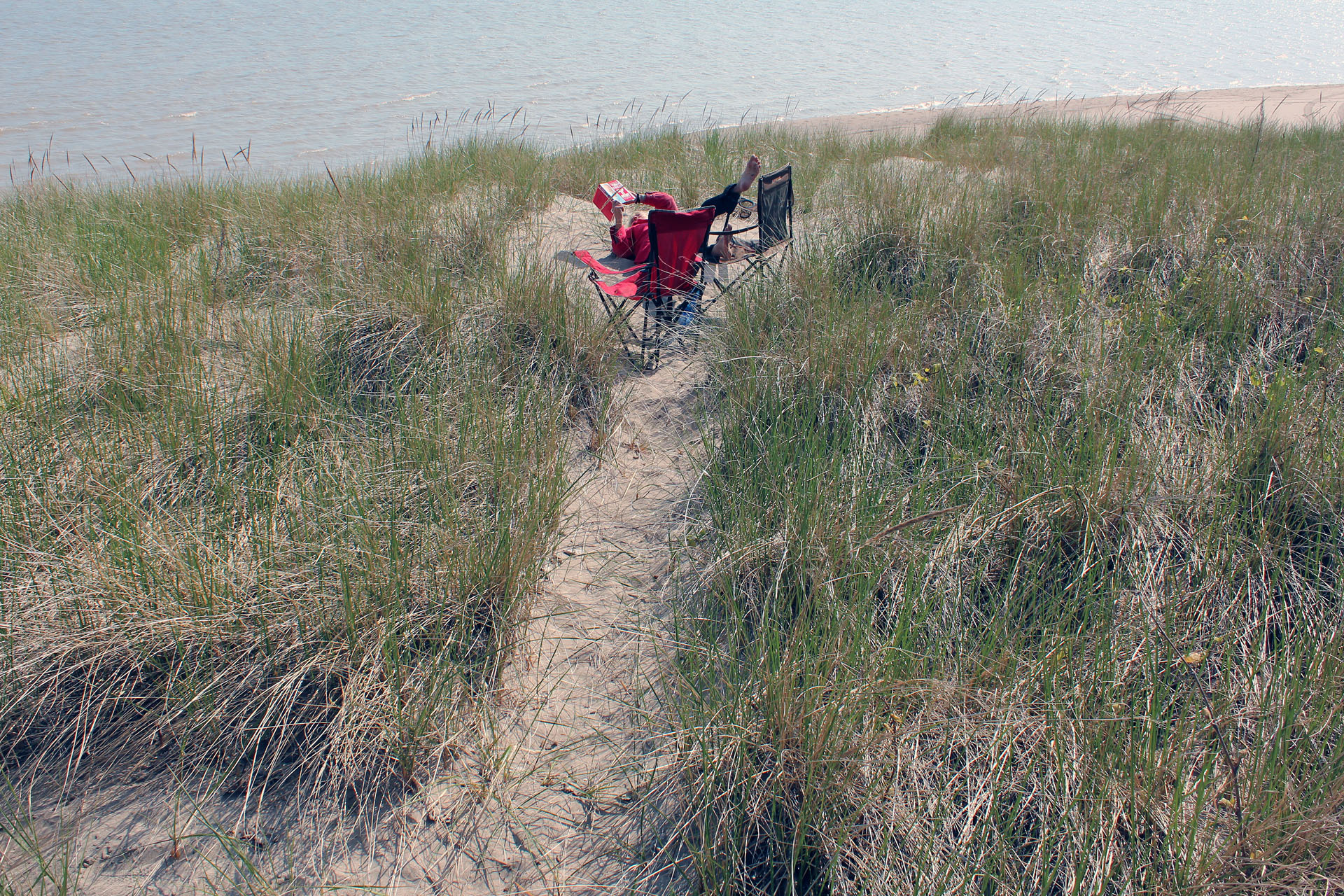 |
| Relaxing in the dunes |
Long Point is very well-known for its bird migration and one
day we visited (for the second time) the Bird Observatory/Field Station,
located on Old Cut Blvd. It was just fascinating to watch the staff (partially
made up of volunteers) catch, identify, measure, weight, band and release
various birds. It was also a great opportunity to learn about birds, as the
staff are very knowledgeable and willing to share their knowledge with
visitors.
We found out that some birds were persistently hanging out
around the observatory (certainly feeders full of seeds were one of the main
reasons) and not only had they been caught numerous times, but sometimes more
than once in one day! A small store sells books and other ornithological
materials. Several informative plates along the nearby trail tell the story of
Long Point and bird migration. Just be careful and do not get caught in the fine
nets designed to trap birds, or you might end up being banded (or perhaps
handcuffed), too! Although I was not interested in birds that much, each visit
to this field station turned out to be a very inspiring, delightful and
thrilling experience.
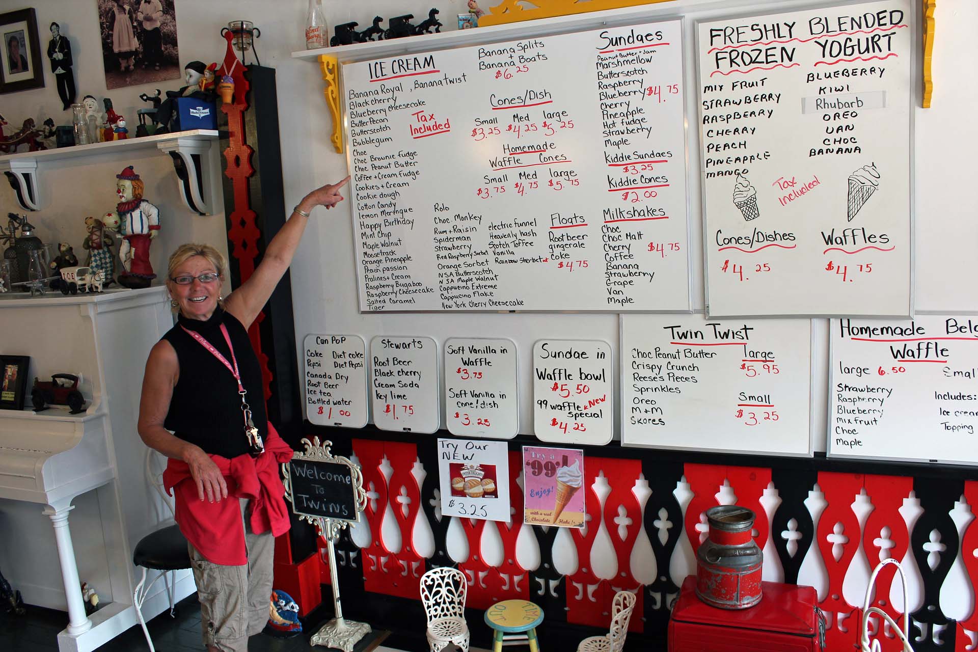 |
| Twins' Ice Cream Parlour |
We went to the nearby town of Port Rowan several times and
of course, each time had excellent ice cream at Twins’ Ice Cream Parlour, as
well as spent a few hours browsing in the Thrift Shop and a well-stocked dollar
store—a lifesaver for campers forgetting needed items or a getaway on a rainy
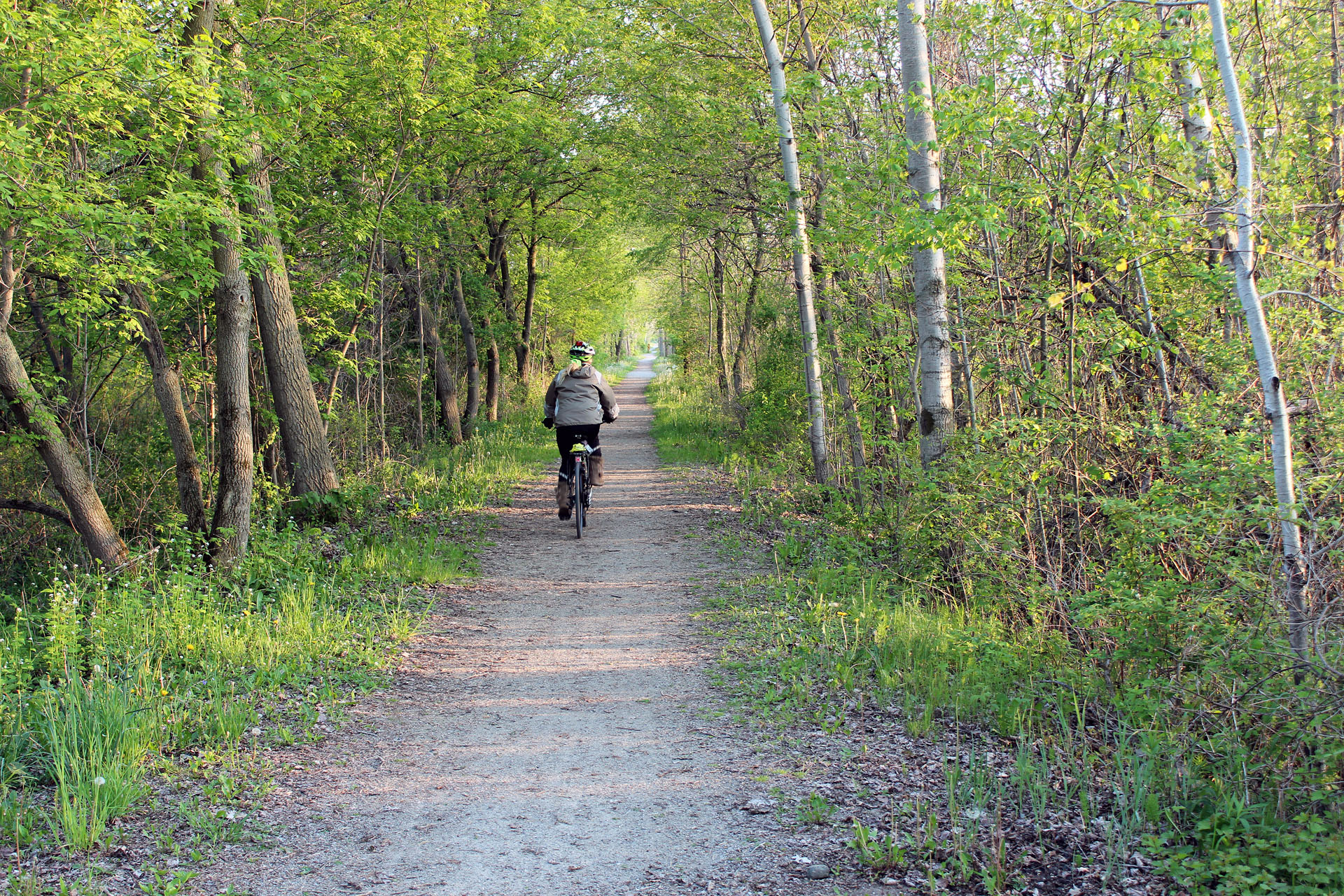
day. Like last year, we brought bikes and were looking forward to riding on
numerous biking trails near Waterford, Simcoe and Delhi.
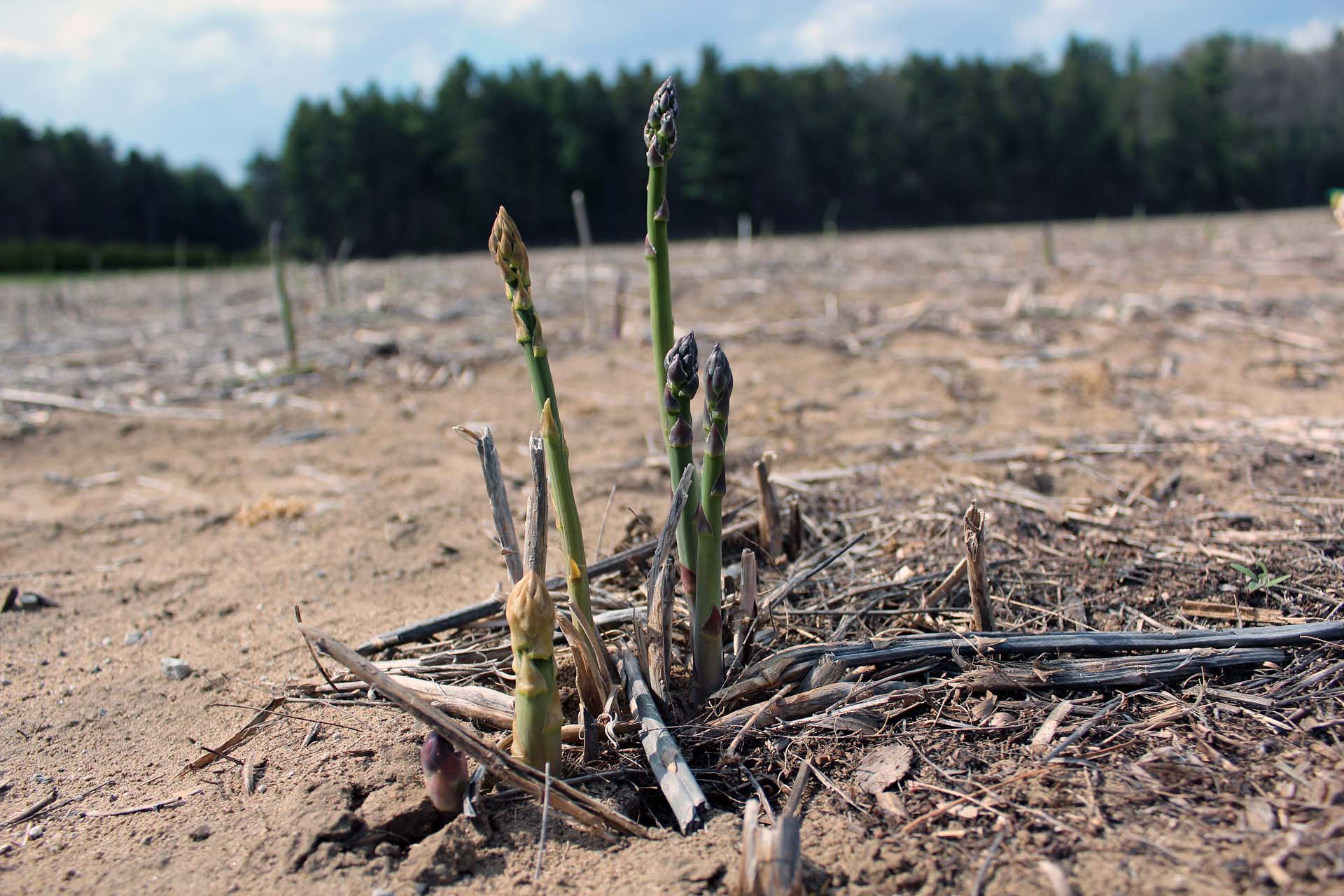 |
| Asparagus |
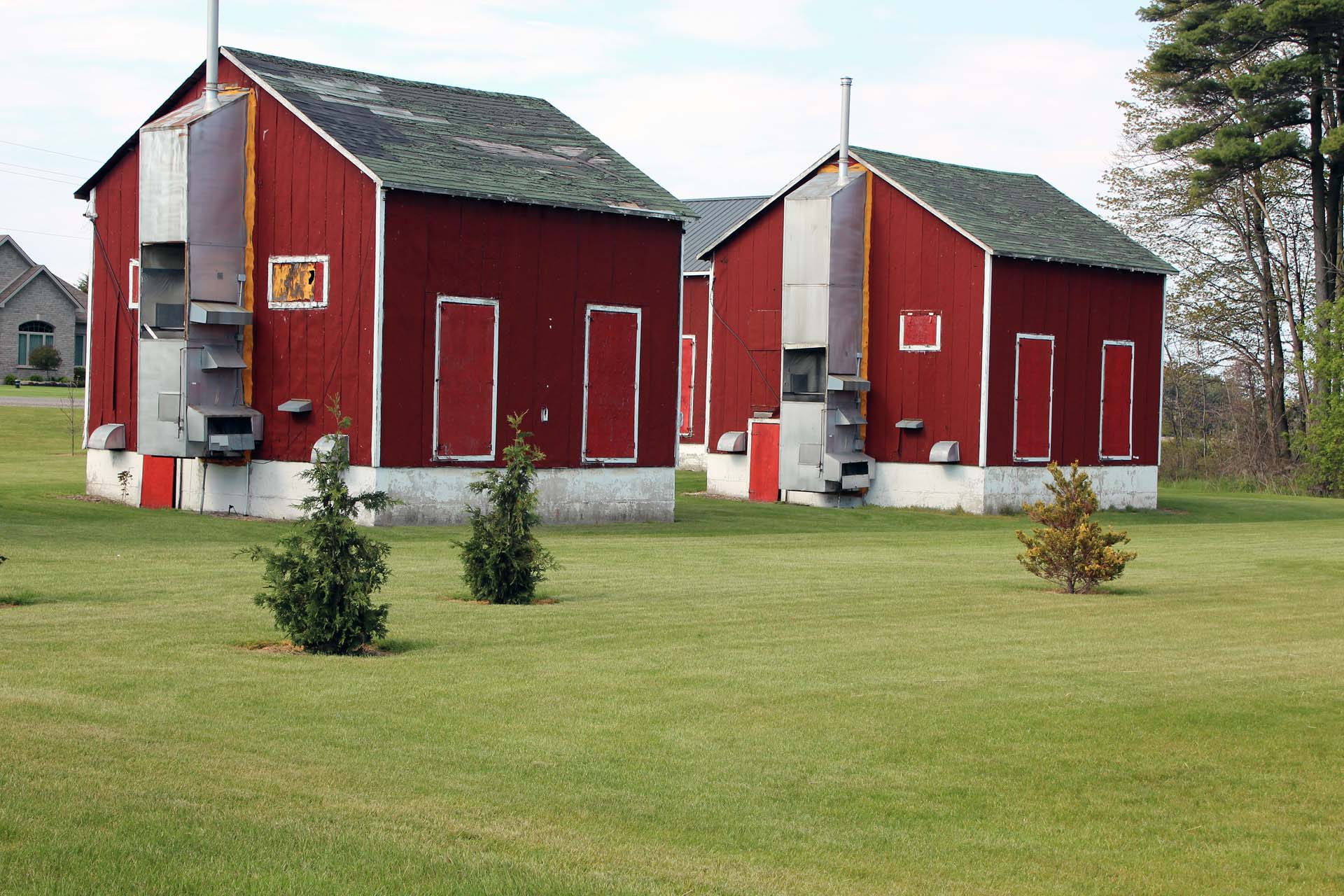
Port Rowan and Long Point are in Norfolk County—a well-known
agricultural area, which has been the center of the Ontario tobacco belt.
Because of the decrease in the tobacco consumption, many farmers have switched
to other crops, like ginseng and asparagus. There were still plenty of almost
historical kilns (curing barns, where tobacco leaves were undergoing a
curing/drying process), often heated by coal—some, semi-abandoned, sat empty,
others transformed into storage.
Many farmers have decided to switch to farming ginseng, yet
it requires a large investment of capital and it takes at least three years
before the first harvest. Since ginseng is native to the floor of the mixed
hardwood forests, it requires little sunlight. Thus, fields where ginseng is
cultivated must have been modified to resemble its natural preferences by
erecting shade that can filter most of the sunlight.
 |
| Old kilns |
We also visited several farms growing asparagus—it is said
that one sure sign of the spring season is asparagus appearing in local
stores—or on farms, from which we could directly purchase it. We bought a
couple of very fresh bundles and at the campsite we added some butter, wrapped
them in aluminum foil and grilled over the fire. They were soft and delicious!
 |
| Ginseng plantation |
After planting asparagus, it takes several years before the
first harvest, but amazingly, it is a perennial vegetable and can be productive
for 20 to 30 years if given proper care. If the stalks are not picked they will
grow into tall fern like with small red seeds. There were a number of workers
employed on the farm—some harvesting, others sorting and washing asparagus.
Many of them were seasonal workers were from Mexico and Caribbean countries,
they annually come to Canada to work on farms, since not too many Canadians are
interested in such work—they much prefer living comfortably in cities, often in
subsidized housing units and collecting social assistance (i.e., welfare) which
the Liberal governments in Ottawa and Ontario generously bestow on them, almost
no questions asked. O, Canada… I feel like crying…
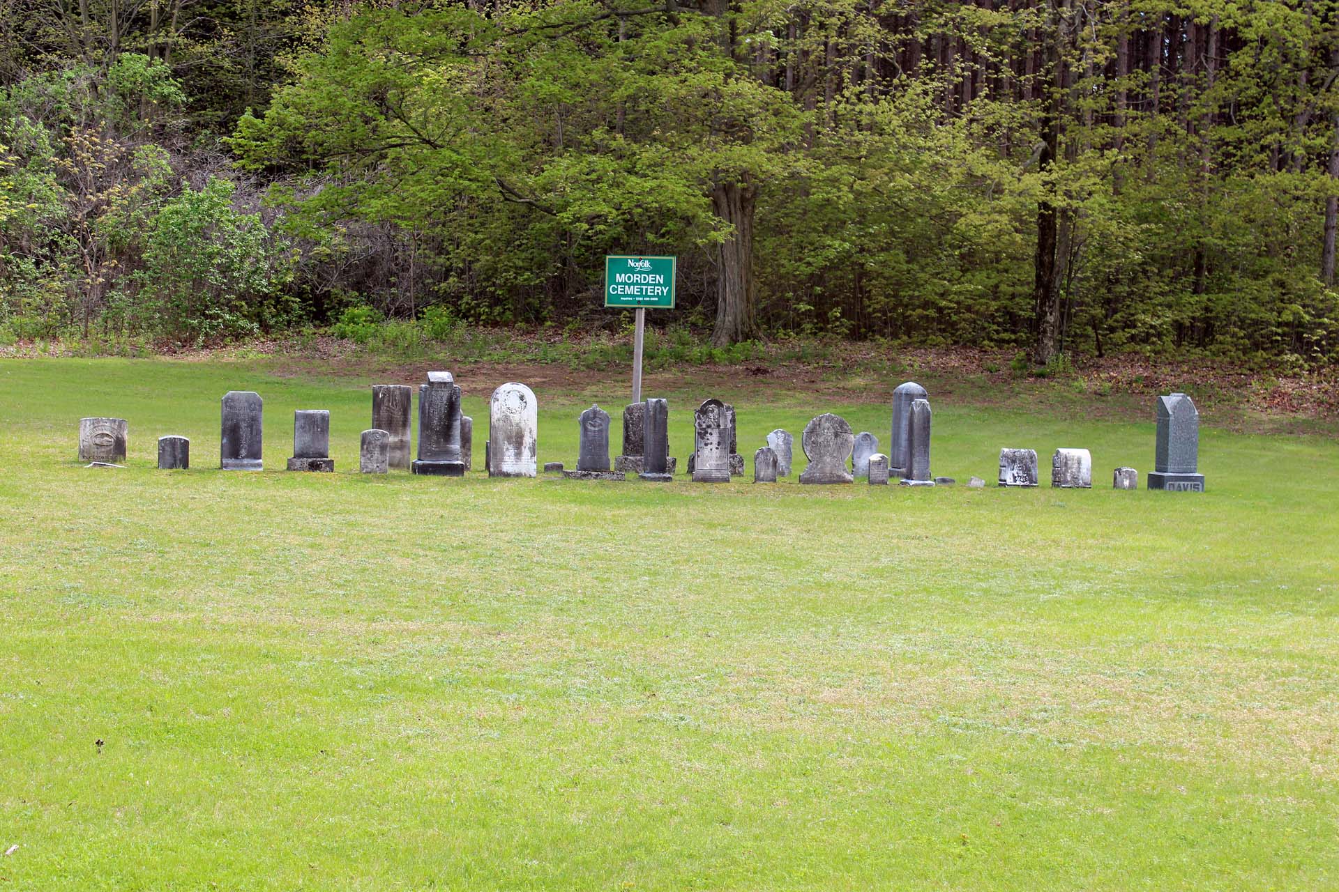 |
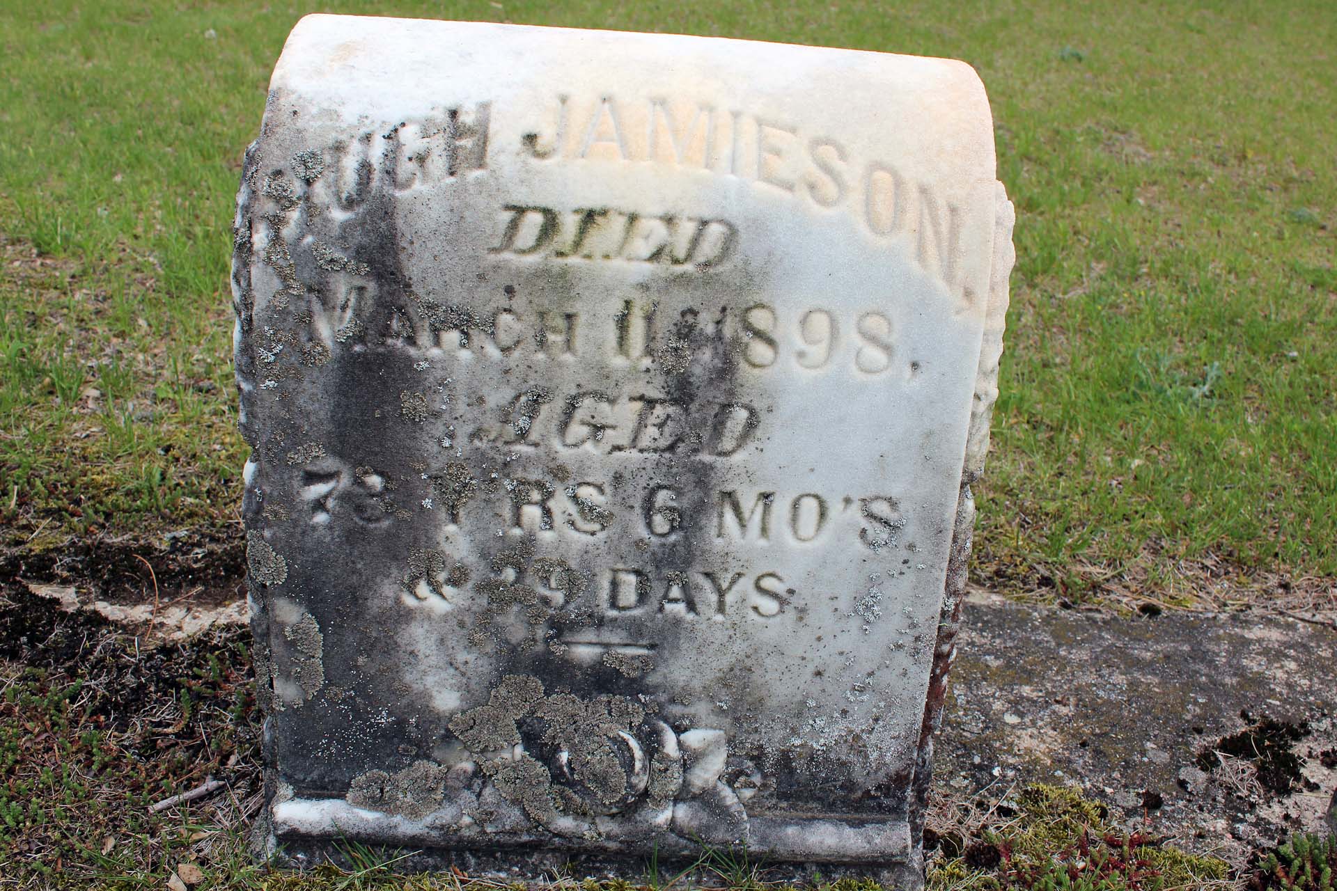
| Morden Cemetery |
While driving from the park, several times we passed by the
Morden Cemetery, located at Concession Road East and East Quarter Line. It was
an ‘abandoned’ cemetery, operated by Norfolk County (which has one hundred and
eleven documented burial sites/cemeteries). Such cemeteries are quite common in
Ontario. Unfortunately, many headstones got lost, vandalized, broken and
unreadable and local authorities decided to just collect them and erect them in
one place, not necessarily at their original locations. Most of the burials
occurred at the end of the 19th century and beginning of the 20th
century. Many of the graves are children’s.
DELHI RAIL TRAIL
Although it was very windy, we drove to Delhi and found the
beginning of the Delhi Rail Trail (which runs almost 14 km from Delhi to
Simcoe) on Fertilizer Road, near the Co-op Fertilizer Plant. Surprisingly,
there were semi-abandoned tracks on the other side of the road and they
actually ran parallel to the Delhi trail for about one hundred meters. They
were part of Trillium Railway, also known as the St. Thomas & Eastern Railway,
operating between Delhi and St. Thomas, which carried fertilizer, grain, salt,
ethanol, forest products and other goods. The line ceased local operations at
the end of 2013. The rail lines were established by the Great Western Railway
in 1873 and the Simcoe-Delhi line must have been abandoned several decades ago.
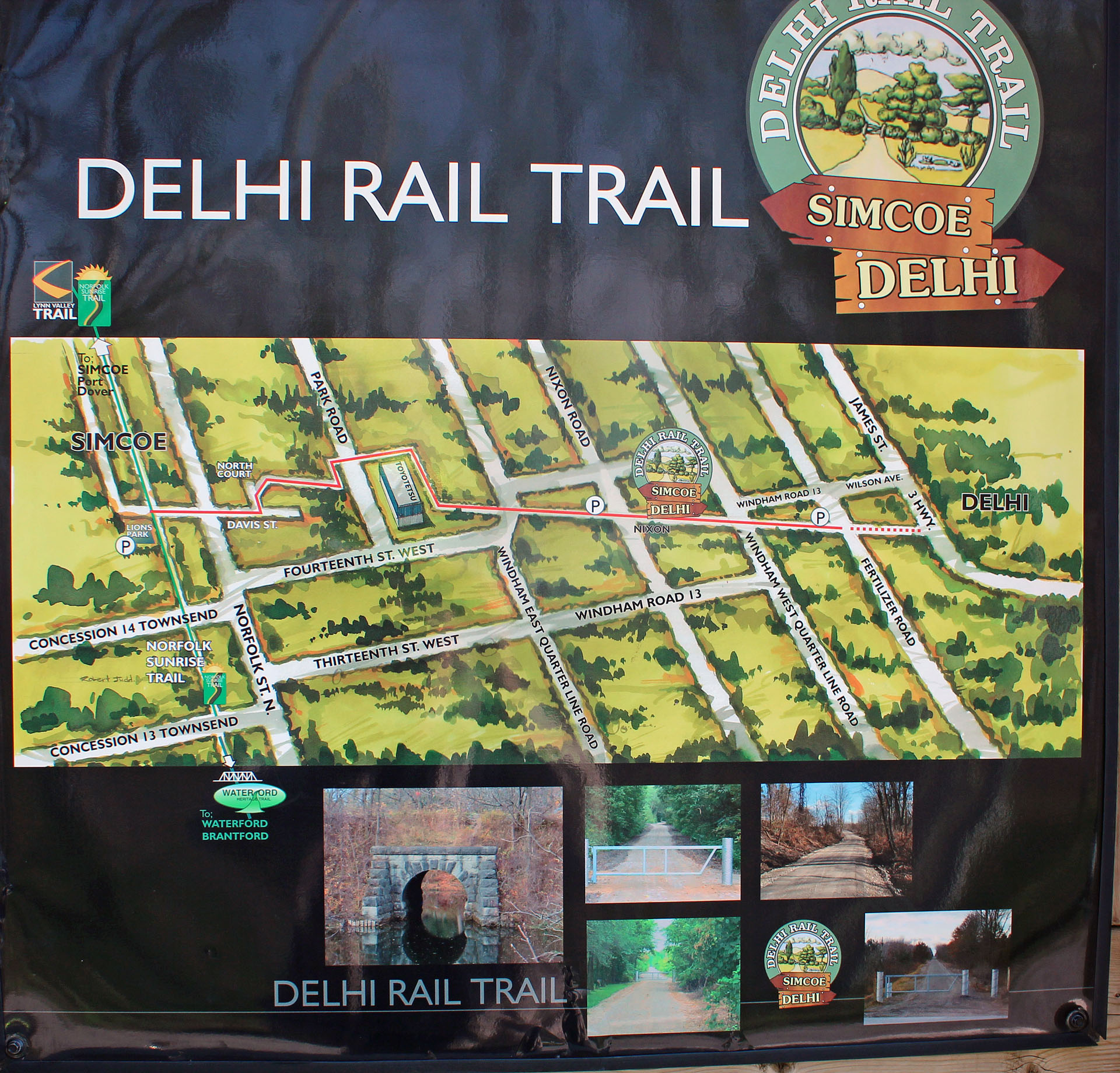 |
| Delhi Rail Trail |
There was a small parking near Fertilizer Road and several
informative plaques. The trail passed through fields and forests, sometimes
very close to farmers’ buildings and crossed several roads. We saw some other
people also using the trail-cyclists, joggers and hikers. The shoulders of the
trail had plenty of poison ivy. Because it was very windy, we decided to turn
back a few kilometers before reaching Simcoe. Overall, it was a very easy, flat
and scenic trial, perfect for beginners.
WATERFORD HERITAGE TRAIL
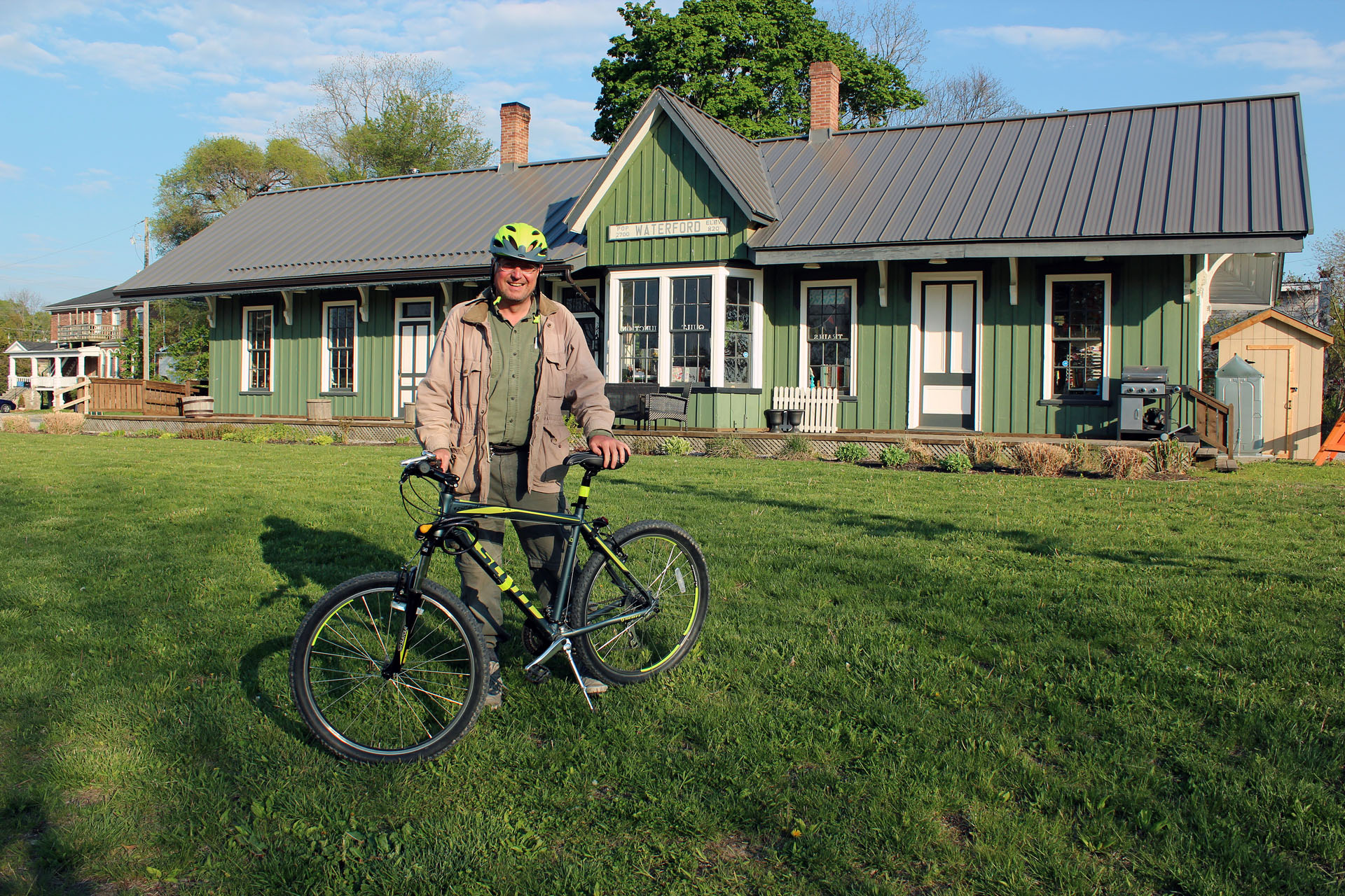 |
| Old Waterford Train Station |
The Waterford Heritage Trail is almost 20 km long and passes
through forests, wetlands, fields and grasslands. It follows the right of way
of the Lake Erie and Northern Railway (LEN), which commenced operation from
Galt to Port Dover in 1915, transporting passengers and freight. It made stops
in Galt, Brantford, Waterford, Simcoe, Port Dover and other places in between.
The passenger service was discontinued in 1955. The line between Waterford to
Simcoe was abandoned in the early 1990s.
 |
| The Black Bridge |
The most prominent—and still existing—feature of the LEN is
the imposing Black Bridge that carried it across the Toronto Hamilton and
Buffalo Railway (THB) and Canada Southern (CASO). In the past Waterford was an
important railway hub. Passengers could go by train not only to New York, but
also to Detroit and even Chicago. The passenger service on the THB line ended
in the 1960s and freight service in the late 1980s, when the route was
abandoned. Remarkably, up to 120 trains per day used to pass through Waterford!
We departed from Simcoe at Lion’s Park (on Davis Street
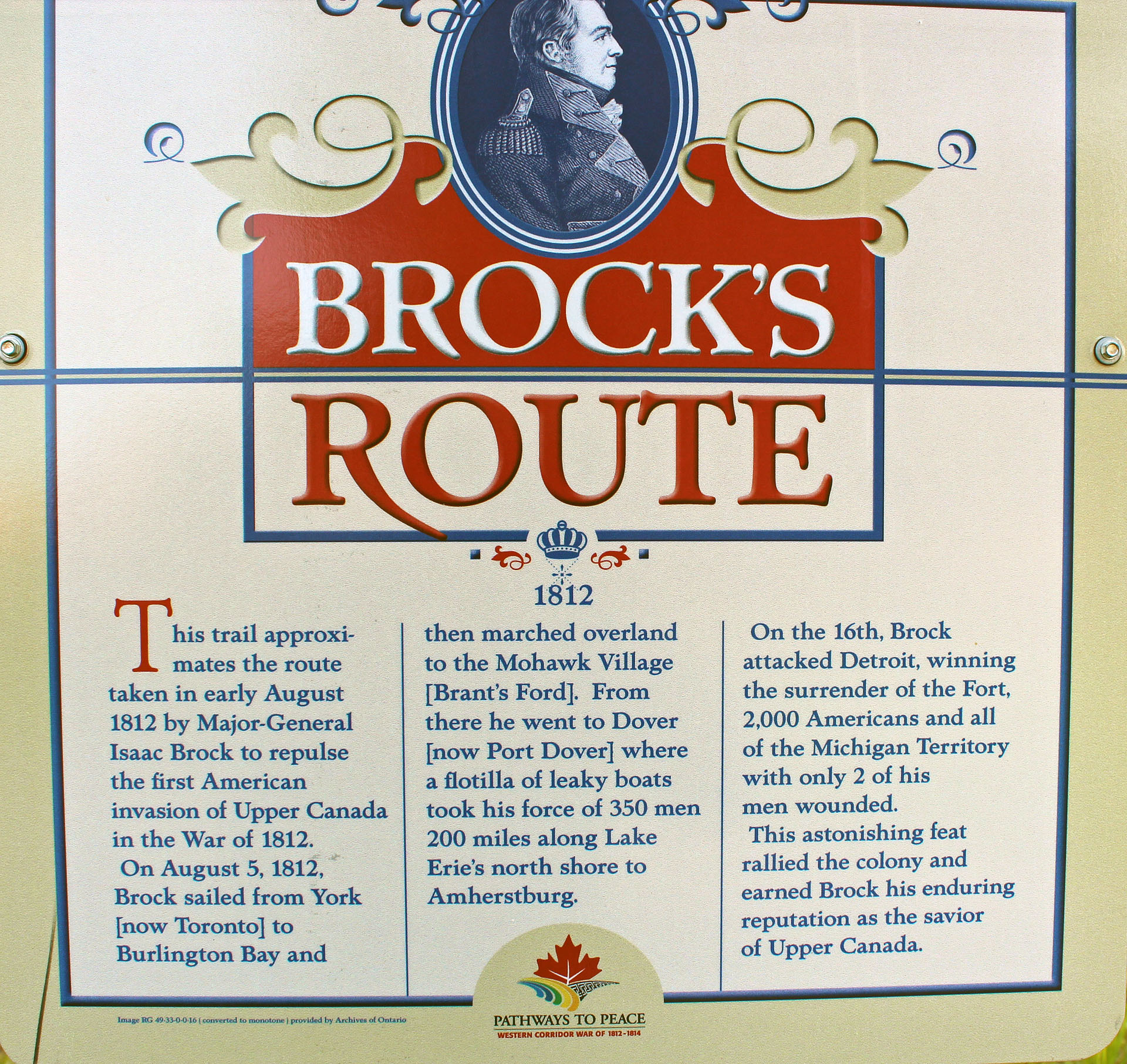
East), which had ample parking. According to the information plaques along the
route, this trail is part of what is known as “Brock’s Route”—it is for the
most part aligned with the route that Major General Isaac Brock took between
Hamilton and Port Dover through Brantford in the war of 1812-1814.
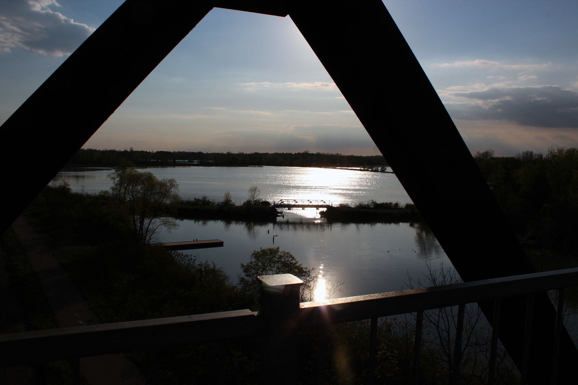 |
| View from the Black Bridge towards another old rail bridge |
After riding for 9 kilometers, we arrived in the town of
Waterford. On our right (at the end of Nichol Street W) stood big silos, now
apparently abandoned—their side draws, designed to unload their content
directly to railways cars, were still in place. The empty site across from the
silos is where the LEN station once stood.
 |
| Brock's Route |
We continued for about a hundred meters and reached the
impressive Black Bridge (which just celebrated its centenary), now modified for
the new trail users. From the bridge we could admire Waterford Ponds and the
town of Waterford. There was also a small pedestrian bridge—I think that once
it had connected the LEN and THB.
As we did not have the time to continue on the trail towards
Brantford, we retraced our route for approximately 600 meters, where the trail
split—I guess it had been another junction connecting the LEN and the THB. We
took the other sloping paved trail, turned right under the Black Bridge and
ended up riding on the THB and Canada Southern right of way. A few minutes
later we arrived at the old railway station of the Canada Southern Railway
Company at the west end of Alice Street ( its sign still proclaiming,
“Waterford. Pop. 2700. Elev. 820”). This modest station, built in 1871,
resembles train stations in the USA. Fortunately, not only has it been
preserved, but also thoroughly renovated and now it is the home of “Quilt
Junction”.
 |
| The Waterford Heritage Trail |
After enjoying two slices of pizza at a local pizzeria and
cycling on several streets in town for a while, we got back to the trail via
Nichol Street and returned to Simcoe.
Altogether it was an easy and very pleasant excursion which
also allowed us to learn so much about local history. Kudos to the
organizations and individuals that maintain this trail!
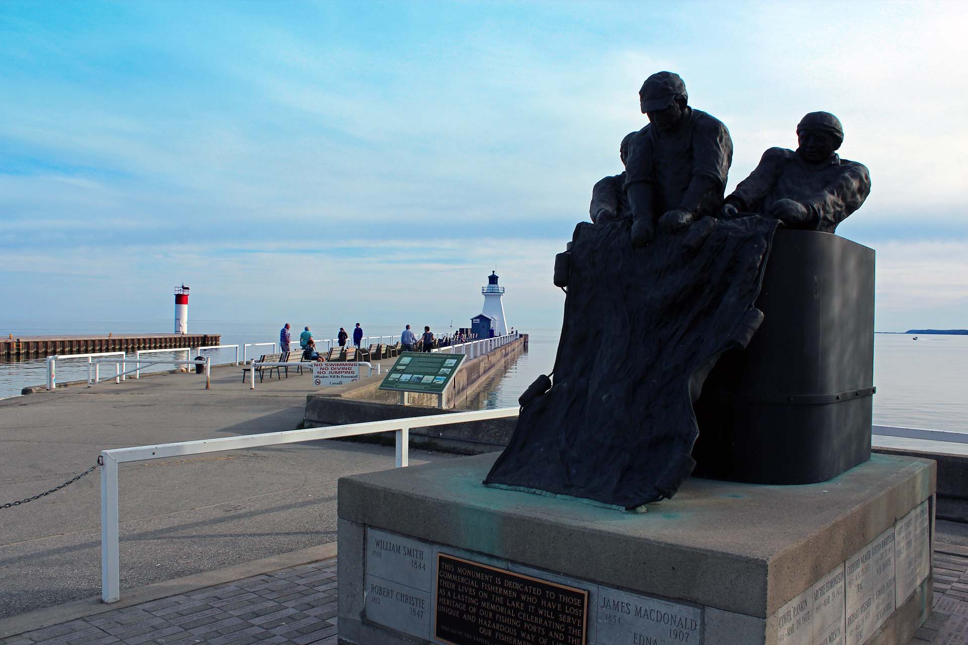
PORT DOVER
We drove to Port Dover en
route home to Toronto just a week after the Friday the 13th
celebrations, when thousands of motorbikes descended on this small town. In
fact it was the Friday eve of the May long weekend and very busy once again. We
walked to the lighthouse, then bought a pizza at Harbour Pizza and had it while
sitting near the Port Dover museum, on the Lynn River. We got chatting with a
local lady. Catherine asked her about a newly opened Bed & Breakfast on the
former Clonmel Castle Estate property and got directions to visit. It was still
a beautiful stone-fenced property that looked straight out on an Irish movie
set, but had been subdivided and had a new subdivision of upscale homes just
meters from the entrance. There were a number of very informative plaques along
the Lynn River with photos and interesting facts pertaining to Port Dover’s
history and I took liberty in reproducing some of that text below.
 |
| Pizza delivery in Port Dover! |
In the 1840s the mouth of the Lynn River was dredged and the
first piers and lighthouse were built. Soon commercial wharves and warehouses
sprang up along the banks of the Lynn River. They were essential for loading
and unloading the trading schooners, which made regular stops here, bringing
manufactured goods and other merchandise and taking away farm products, lumber
and tanned hides. With the coming of the railways in the late 1800s, schooner
trade fell off and the harbor and creek sides became the domain of commercial
fishing boats.
 |
| Port Dover |
In the twentieth century Port Dover was the heart of
Canada’s freshwater fishing industry. The stretch of the Lynn River was once
lined on both sides with net shanties, docks and processing plants associated
with these fisheries. By the 1970s Port Dover was home to the world’s largest
freshwater fishing fleet. Well, I only spotted one old shanty on the other side
of the river.
There were several photographs on the plaque, depicting the
banks of the Lynn River in the late 1890s and early 1900s—and red dots
indicated the exact spot where we were standing now. Indeed, it was just
unbelievable to look at all the structures that dotted the shores then—almost
all of them now gone! It remained me of the ghost town of French River in the
mouth of the French River: old photographs showed numerous buildings standing
on the rocky shores—when I visited that place in 2008, I could only see the
lighthouse and the ruins of a once very tall chimney. Time marches on…
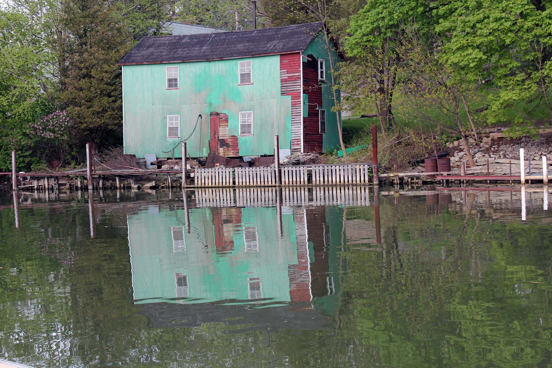 |
| Port Dover, an old shanty |
When the prohibition was introduced in the United States in
1920, commercial fishermen on Lake Erie were experiencing one of their
industry’s cyclical downturn—what a wonderful coincidence! Soon boxcars full of
whisky were appearing on railway sidings and their contents were shipped across
the lake aboard a variety of craft, and then transferred to American vessels.
Thousands of cases of Canadian whisky and beer made their way to American
speakeasies. With the end of the prohibition in 1933, this colorful era was
brought to an end as well.
 |
| The story of my life |
Near Port Dover we briefly stopped at Canada’s First
Forestry Station and Interpretative Center and drove around for a while. This
station was established by the Ontario government in 1908, on 40 ha of
wind-eroded sandy land. There was a huge tree trunk on display, its growth
rings clearly visible. The information plaque, “The Story of My Life”, was
explaining the history of this 277 year old tree—in its own words!
“I
grew from an acorn in 1723 along the bank of the Lynn River, when there were
only native people in this region … When I was 25, in 1750, I could start
seeing what was going on around me … I saw horse-drawn carriages travelling
along Norfolk Street … In 1795 the popular governor John Graves Simcoe came to
visit our county and camped close by …In 1812 war broke out with the United
States and I could see the militia practice all around me … In 1914 there was
war again and many soldiers practiced where I could see them before they went
off to fight in Europe … The farmers had cut down too many trees and the good
soil was blowing away. In 1908 a few people at St. Williams had started a
nursery to try to stop the dust storms by replanting the trees … In about 1980
my end was coming near: new insects from foreign lands attacked my leaves …
Then disease struck my bark and I passed away in the year 2000. I had to be cut
down and people made many beautiful things from me.”
While driving near Simcoe, we spotted a small distillery in
a tiny community of Green’s Corners, which for the last 6 years had been
producing rice-based Silver Lake Vodka. It was possible to buy (or sample) the
product at the distillery, but it was already closed.
 |
| McQueen Cemetery |
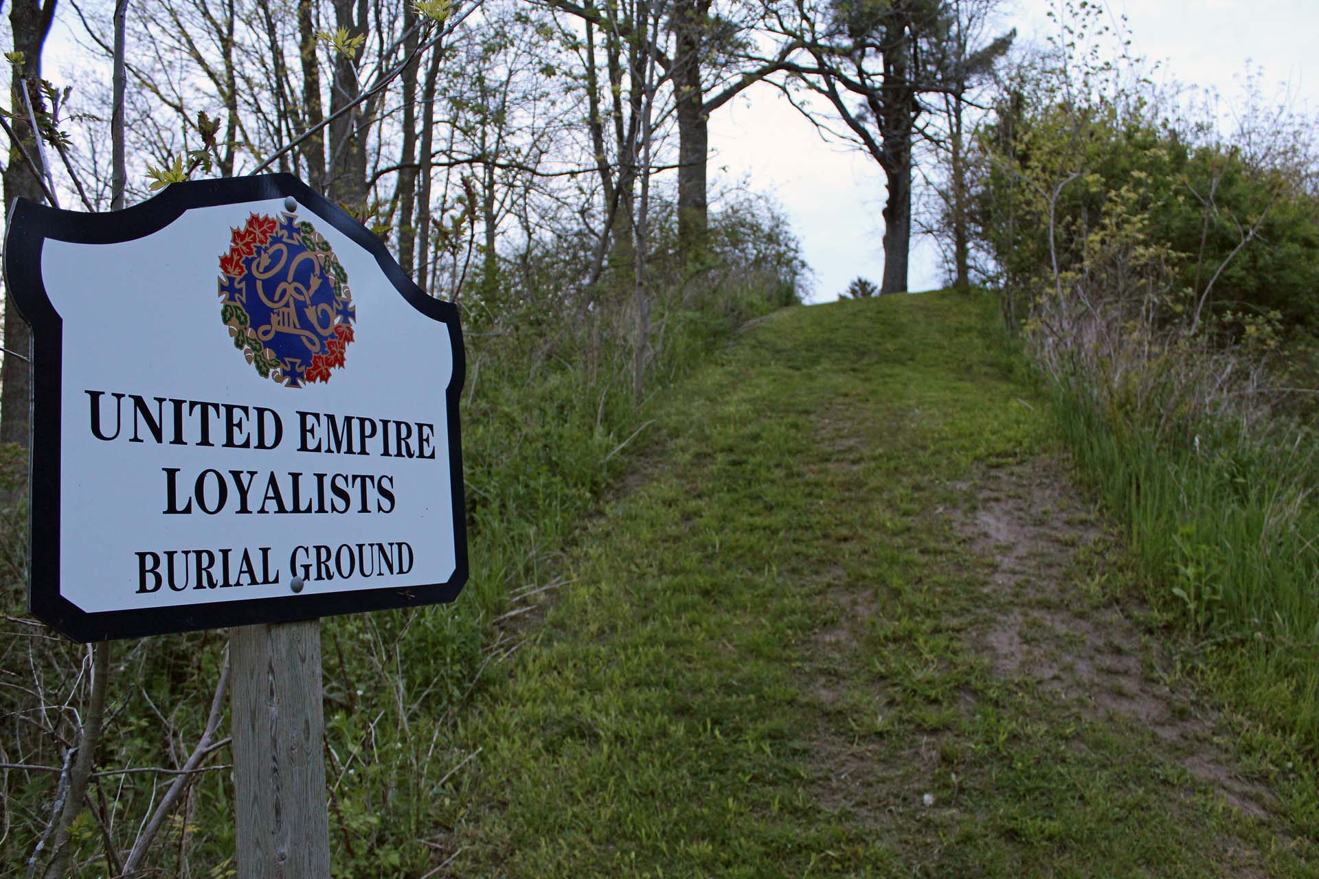
On our way home I noticed a historical plaque in Port Dover—there
was a small McQueen Cemetery-United Empire Loyalists Burial Ground. The United
Empire Loyalists were those who had been settled in the thirteen colonies at the outbreak of the American
Revolution, who remained loyal to and took up the Royal Standard, and who
settled in what is now Canada at the end of the war. Apparently the
McQueen cemetery is on the original McQueen farm in Port Dover. One of the oldest, and most prominent
graves, was that of Alexander McQueen, who died in 1804. The inscription days
the following:
 |
| Alexander McQueen's grave |
In memory of Alexander McQueen
Died 10th July 1804
Aged 93 years
As a highland soldier under the valiant Wolfe,
He helped to capture Quebec and
Win Canada for Britain.
This memorial is erected by one of
His great, great grandsons
Mr. Justice Teetzel
1908
We wished we could have stayed in Long Point Provincial Park
for the long weekend, but as I mentioned before, all campsites had been booked.
It was our first camping trip of 2016 and we enjoyed it a lot!
More photos from this trip: https://www.flickr.com/photos/jack_1962/albums/72157675877697576
Blog in Polish/po polsku: http://ontario-nature-polish.blogspot.ca/2016/10/biwakowanie-w-parku-long-point.html
No comments:
Post a Comment