More photos: http://www.flickr.com/photos/jack_1962/sets/72157628606261077
In the past I had visited Restoule Provincial Park twice—in September 1999 and 2000, also with Christopher, with whom I went there this year. Our both trips were not very successful—in 1999, on the second day after our arrival, the temperature plummeted in the morning to below 0C and soon it started raining—after two miserable nights we rented a cottage on Lake Commanda where we spent the next ten days. It turned out to be a great decision since it would rain very often and once a power storm, with lighting and thunder, kept us awake for hours—but at least we were not roughing it in a tent! In 2000 our trip was nicer, but because we did not have a boat or canoe, we had to rely on renting them which was not an easy task: plenty of resorts had already been closed, those that rented boats were quite expensive and we had to travel far from the park, even to Lake Nipissing, to rent fishing boats—and frequently we were not satisfied with them. This year, however, we brought with us a canoe, so at least we knew we would be able to spend a lot of time on the water and do some fishing.
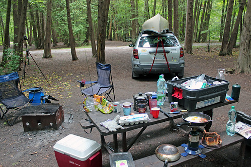
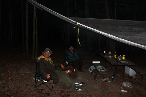
When we left Toronto on September 15, 2011, it was so windy that I was somehow reluctant to drive on the highway (400) with the canoe attached to the roof. In fact, strong gusts of wind were whipping the canoe and twice we had to stop on the highway's shoulder to adjust the canoe—on one occasion 1/3 of the canoe shifted from the roof. Just before reaching Barrie, we got off the 400 and driving on side roads, arrived at the MEC Store (Mountain Equipment Co-Op), one of the best outdoor stores in Ontario. We talked to the store staff and one salesperson even took a look at the canoe and suggested we buy additional, higher canoe blocks. Maybe they helped a little, but we did not feel too confident to continue driving on the highway for the next 200 km. So, we decided to go to Six Mile Provincial Park instead (which we had visited many times for the past 20 years). I took a number of country roads and tried to drive just at the speed limit, yet at one point, when we were on the top of a hill, the wind again caused the canoe to shift a little, forcing us to stop and adjust it. In the town of Port Severn we bought a bag of firewood and after 10 minutes arrived at the park. As we expected, there were very few campers in the park and we could pick any site we wanted (not that we cared that much—after all, we were going to stay there for just one night). We picked site number 68, set up the tent, started the campfire and for the next few hours sat around the fire, drinking beer, grilling sausage and enjoying its warmth as it was quite chilly. Nobody drove nor walked by our campsite nor did we hear any other people. I also realized that I had not brought a mattress and had to quickly make an improvised 'pad', using various pieces of clothing and my life jacket.
On September 16, 2011, we were up before 7:00 am, quickly packed up the tent and in less than one hour were back on highway 400, heading north. We passed plenty of lakes and admired the morning mist rising off the water. Once we reached the town of Parry Town, we had breakfast at Tim Horton's, then I went to a Canadian Tire store, bought a mattress (which proved to be defective and kept loosing most of its air every night—I returned it after our trip). Before noon we arrived at Restoule Provincial Park.
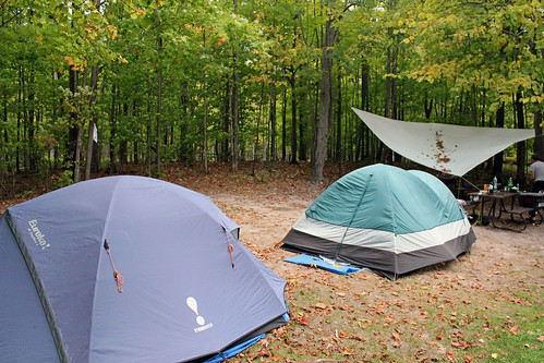
The park's campsites are quite good, yet the privacy level, so to say, is so-so, usually you can see several other campsites and there is not that much vegetation between the campsites. Of course, in September the park was nearly empty, so we were enjoying total privacy and did not see any other campers around. On the campgrounds without electricity (where we stayed) perhaps only 10 campsites were occupied and all of them were near the water, far away from us; the electrical campsites did have quite a few campers, mainly living in trailers. We spent an hour driving on the park's roads, checking out campsites; eventually we decided to choose campsite number 214. It was a good camping site and there were not even distant neighbours during our stay. We were surrounded by beautiful autumn colours, the whole place was covered by fallen leaves which created a 'leaf carpet'. We pitched our tents, spread the tarp over the park bench (just in case of rain) and started a fire. It was a chilly night, so we were sitting close to the fire, enjoying beer, red wine and grilling steaks.
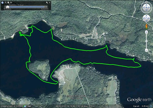
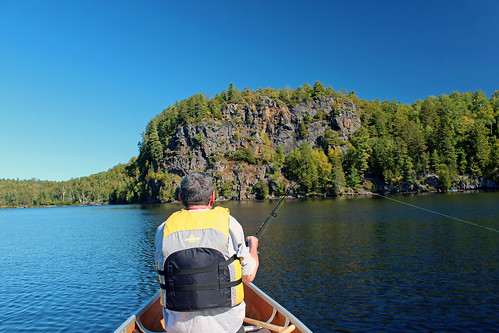
The next day, September 17, 2011 (72nd anniversary of the Soviet Union's invasion of Poland) was sunny, so after breakfast we drove to Restoule Lake, put the canoe on the water, unpacked our fishing rods and paddled all over the lake, stopping from time to time to cast. The lake was quite big and there were plenty of houses on its shores; from time to time a motor boat passed by. After five hours we turned back to the dock, without catching one lousy fish! I went for a 20 minute swim—the water was very cold, but I did not mind and after a few minutes I hardly noticed how cold it was; in fact, I felt very refreshed! While driving to the campsite, we were listening to the CBC news and found out that there was a plane crash in Reno, Nevada, resulting in numerous casualties. Again, we had a nice fire and had delicious grilled steaks.

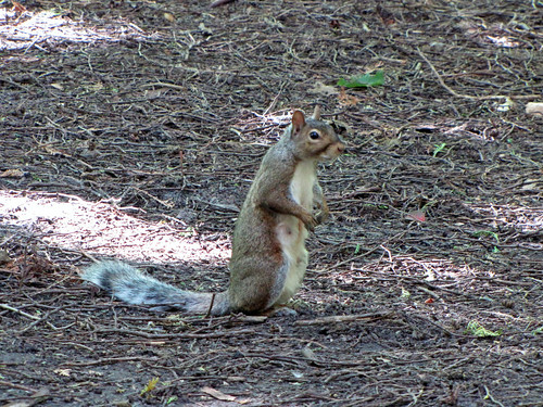
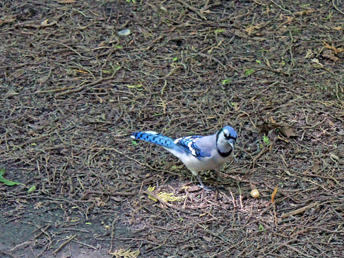
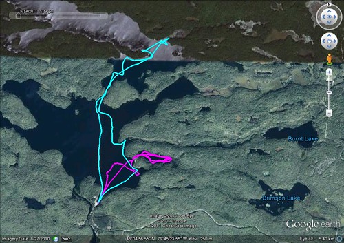
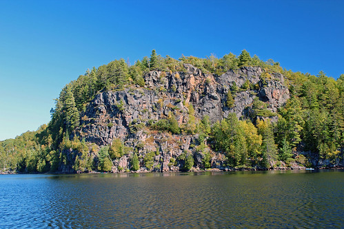
On September 18 and 20, 2011, we canoed on the other lake, located north of the park—Stormy Lake. It was much nicer than Lake Restoule, there were very few cottages and once we departed from the dock, we saw a huge rocky escarpment with a fire tower located on its top. In the old days fire towers were a common sight all over Ontario; a guard would sit there and observe the area—in case of fire, he notified local firefighters. Now planes or helicopters are performing such duties and fire towers have become tourist attractions. We also found out that Restoule Park had a number of interior campsites, accessible only by water. It was a pity we were not aware of them—we could have stayed on an interior campsite! When we were leaving the park dock, a motor boat, driven by a lone woman and laden with camping equipment just docked. Apparently, she just returned from an interior camping trip; she told me she had stayed on crown land, where everyone could camp for free, but she also mentioned the park's interior campsites. Indeed, about 15 minutes from the dock and nearby the rocky escarpment, we found an interior camping site; about 50 meters behind that site was Hazel Lake. Since an angler told us it was a good lake to catch a pike, we decided to try our luck there. There used to be a short channel connecting Hazel Lake to Stormy Lake years ago, but now a big beaver dam was erected between the two lakes. Chris bravely carried the canoe to Hazel Lake. It was a small, yet very picturesque lake! There were a lot of beaver lodges all over the lake and soon we spotted a few beavers swimming in the water. We paddled to the end of the lake and back, casting and trolling all the time, yet did not catch anything. Chris again portaged the canoe to Stormy Lake and we tried our fishing luck on that lake again—to no avail! Then we paddled to the north and reached Clear Lake. It was probably in that area that we could camp on crown land, as we did not see any cottages and it did not belong to the park either. We met one fellow who had a motorboat and from the number of fishing equipment we could infer he took his fishing hobby very seriously! He said he had been fishing in this area for 40 years and also complained about poor fishing (i.e., he did not catch anything either—he said fish had disappeared since August). He told us a story about coming across a wreck of a military plane that had crashed in the dense wood in the 1950s. We also spoke to other fishermen—most of them had motor boats, sophisticated fish finders and about 20 fishing rods—and they had not caught anything either. So, at least we were in a good company!
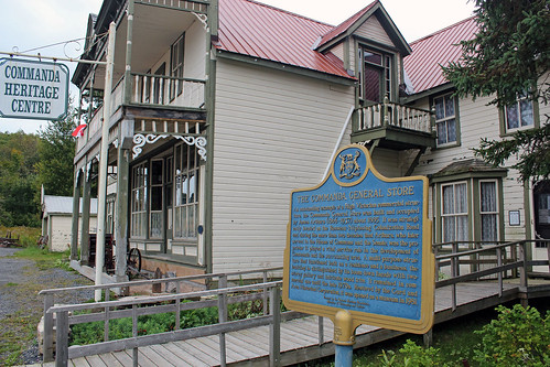
Once day, when the weather appeared to be uncertainly, we drove to the town of Powassan and had lunch in “The Hawk & Fox Restaurant”. It was a typical local restaurant, where everyone knew everyone and most customers were regulars. I noticed a photo of a young girl displayed inside—her name was Amber Lynn Booth, she used to work in the restaurant not long ago (as well as she had worked in Restoule Park). On June 5, 2011, she died in a car accident shortly after getting her driving licence, she was only 20 years old. Another tragedy that happens every day... After lunch we drove around town—in 2000 we had gone to a nice coffee shop called, if my memory serves me well, “Cobbler's Corner” and talked to its owner, but now the restaurant was gone. We also drove on many back roads between Powassan and Restoule Park. We passed a very impressive Catholic Church in Alsace, located almost in the middle on nowhere (more about this church: http://www.toeppner.ca/Alsace_Cemetery_Project/history.html). We also drove on “Rousseau-Nipissing Colonization Road”, built in 1866—one of many colonization roads that the Canadian government built to encourage pioneers to settle in the north. We stopped at the old store, “Commanda Store”, a beautiful Victorian building from 1855, strategically located near the colonization road. For many decades it was an important trading place for passing travellers. Its owner, James Arthurs, was a Member of Parliament and Senator for almost 30 years, representing in Ottawa the local constituency.
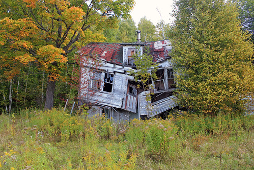
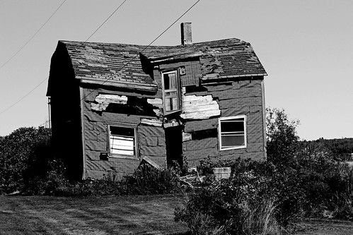
The town of Restoule has changed since our last visit. There are more stores and it was even possible to buy beer and alcoholic beverages there (previously we had to drive to Powassan). We also went to the local landfill to see bears, but we did not see any, yet we saw bear poop everywhere. We visited an apiary and then went to a farmer on the other side of the road to get campfire wood. He talked about the town of Restoule, when it was so isolated, and the hardships faced by the early pioneers. He pointed to an old gentleman sitting nearby, who was about 80 years old, and said he still remembered the original pioneers. I asked him about farming in the area, as I had seen several farms here and there (Restoule is located on the Canadian Shield, where the soil is very poor and rocks are scattered all over). He said farmers had it very hard, some tried to cultivate wheat and cereals but they could not even break even. He mentioned that often you could see, in the middle of the forest, remains of abandoned farm buildings—in fact, I have also run into such remnants. In the nineteen century, many immigrants, encouraged by the government promise of free farmland (and by the colonization roads, which were supposed to take them there), kept coming and settling in the area, along the colonization roads. Of course, they realized that there were rocks everywhere, but they also saw huge, hundred years old trees that were growing on those rocks, so they figured out that if this thin layer of soil could support such dense forest, it would certainly be suitable for farming and agriculture. Unfortunately, they were wrong! At the beginning, where there was a thriving logging industry, it was possible for them to supplement income by trading with loggers and selling their modest agricultural products to them as well as obtain some logging work. Once the land was cleared of trees, erosion set in and very quickly the already poor soil was being washed away and became unsuitable for any crops. Soon, all the trees were cut down and loggers moved out of the area, causing the farmers to lose an important source of income and many customers. Transporting their products to towns on terrible, rugged and often impassable roads was totally uneconomical. Thus, most of the settlers simply abandoned their farms and moved on to better lands and only those stayed who were lucky to get a farm with a thicker layer of soil that could sustain some agriculture and cow & pig farming. Abandoned houses, some over 100 years old, have been almost completely absorbed by the forest, but often one can see a mound of stones in the middle of a forest—a sign that someone had tried to fight with the forest, tried to farm there and cleared the land of rocks, often with his bare hands—yet lost his battle, leaving such ghostly signs of his brief presence.
On September 22, 2011 we packed up and again drove to Powassan to the “Hawk & Fox Restaurant” where we had breakfast and several hours later reached Toronto.
Blog in Polish/Blog po polsku: http://ontario-nature-polish.blogspot.com/2011/09/restoule-provincial-park-on.html
More photos: http://www.flickr.com/photos/jack_1962/sets/72157628606261077