[Philip Edward Island] is a paddler’s paradise(...) the opportunities for canoeing and kayaking here are exceptional.—Kas Stone, photographer, hiker, canoeist and author.
[Circumnavigating Philip Edward Island] is a fantastic 5-to-7 days route that has been rated by a number of leading canoe and kayak magazines and websites as one of the top ten paddle destinations in North America.—Kevin Callan, author of many books on canoeing in Ontario.
When you travel along the north shore of Georgian Bay, you are travelling in the footsteps of history.—Jonathon Reynolds i Heather Smith, „Kayaking Georgian Bay.”
Prehistoric... frozen in time... ancient, silent, mountains rising from the deep green-blue water; islands worn smooth by hundreds of thousands of years of waves licking at their shores (...) These are the things that come to mind when trying to describe the heavy atmosphere of the Bay’s northern shore.—Russell Floren and Andrea Gutsche, “Ghosts of the Bay”.


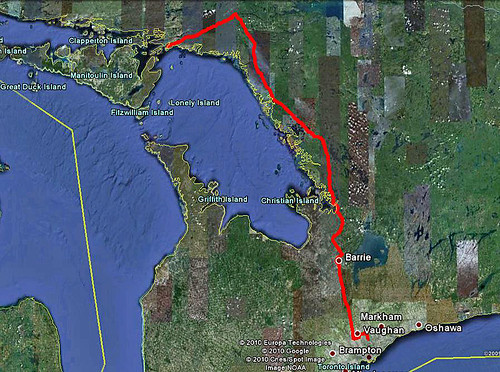


Departing Toronto—August 11, 2010
We had been planning this trip since December, 2009—it was during a presentation by Kas Stone, a freelance writer and photographer, when she mentioned Philip Edward Island—and once we realized that this was one of the 10 best canoeing trips in North America and did not require any portaging, we were, so to say, sold!
We had done some online research on this trip, read books by Kas Stone (“Paddling and Hiking the Georgian Bay Coast”), Kevin Callan (“A Paddler’s Guide to Killarney and the French River”) and Jonathon Reynolds and Heather Smith (“Kayaking Georgian Bay”) and the more we were finding out about this area, the more our excitement and anticipation grew! We had had paddled in that area many times (French River, Pickerel River, the Massasauga, Killarney), yet paddling around Philip Edward Island certainly was something different, something more challenging and exciting.
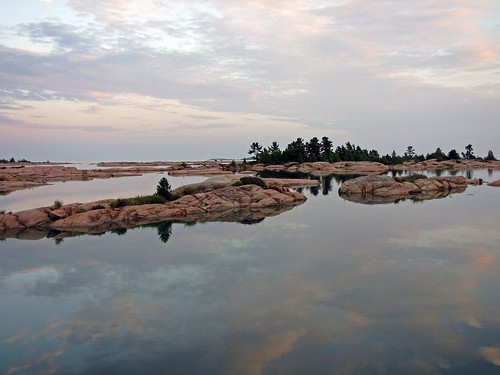
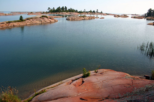
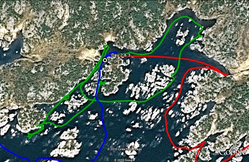
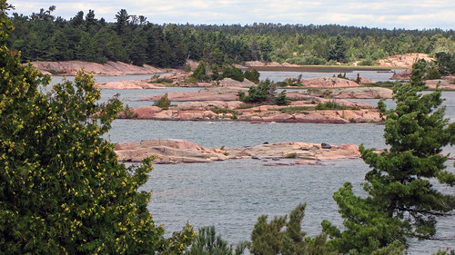
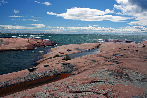
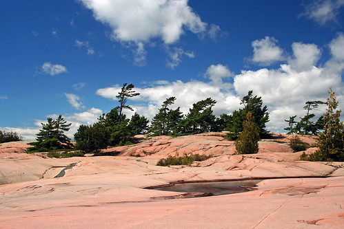
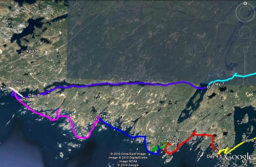
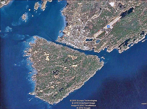
Philip Edward Island, located in the northern part of Georgian Bay, just south of Killarney Park, is about 19 km x 5 km, and is not part of any park—miraculously, it is still crown land, so no reservations or fees were required and we could camp anywhere we pleased. The island itself is a geological gem—formed by about 1.6 billion years ago, then more recently (i.e., between 4 million and 12 thousand years ago) covered many times with sheets of ice, which scoured away soil and rocks; also, glacial melting carved incredible shapes in the bedrock. That is why the southern part of the island is composed of hundreds or even thousands of small islands, rocks, bays, inlets, coves which only enhance the canoeing experience.
Henry Wolsey Bayfield, the British surveyor and later admiral, surveyed Lake Huron after the war of 1812 and named the island and the inlet after his assistant, Philip Edward Collins. He also named hundreds of other places—since the area abounded with islands, he soon ran out of the more distinguished names and started naming them after his friends, the crew and even the crew’s relatives and friends.
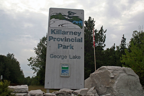
So, eight months have passed since that presentation... and here we were, ready to embark on our journey! After one hour of packing, we left Toronto before noon and in no time were cruising on Highway 400 up North. About 2 hours before arriving in Killarney Park, we stopped at Grundy Lake Post, where we stored our newly-bought canoe, a Kevlar “Adventurer”, and put it on the roof of the car. It was to be the second trip we were embarking on with this canoe, yet we were confident it would be up to the challenge. We passed the Pickerel River (where we had paddled less than one month ago), the French River (we had paddled there many times over the past 2 years) and less than an hour later we turned left into road no. 637, leading to the Town of Killarney—as well as Killarney Provincial Park. We saw several cars, most of them carrying kayaks or canoes on their roofs, as well we spotted a titian fox on the side of the road—alive, that is! Eventually we reached the main gate of Killarney Provincial Park.
As expected, we were greeted by a large sign, “Campground Full”. Fortunately—and luckily—we had managed to reserve the only available site # 36 just days before. The site turned out to be quite nice, close to the showers and main building. Not that we cared that much—after all, we were only staying there for one night. I set up the tent and started a campfire as it was getting dark. Our dinner consisted of excellent salmon (alas, I did not catch it—it was Catherine who bought it in Toronto). A warden came to our campsite to advise us about keeping our food hidden in the car because there were plenty of raccoons in the park. Since we mentioned we were going to circumnavigate Philip Edward Island, we spend some time chatting with him about this trip—of course, he had done it several times. Perhaps 30 minutes after he left, several raccoons came to our campsite. Totally not intimidated by our presence, they sniffed at our gear and quickly overturned the barrel (where we kept our food); not being able to open it, they moved on—after all, there were well over one thousand other campers in the park! We hit the sack after midnight.
Day One—August 12, 2010
We had coffee and oatmeal for breakfast—and all of our breakfasts over the next 9 days were like that—simple, quick and very healthy. Once we packed up the tent, we drove to the park building to purchase a parking permit to park our car at the access point at Chikanishing Creek. Even though Philip Edward Island is still crown land, the parking lot is in the park. The price was exorbitant--$14 per day! It was a lot, almost as much as one can expect to pay for parking in downtown Toronto! Well, it seems the Ontario government decided to take advantage of its relative monopoly for the access to Georgian Bay and like private businesses, wants to make money. So, for 9 days of parking costs $126 (yet it is possible to buy an annual pass for just over $100).
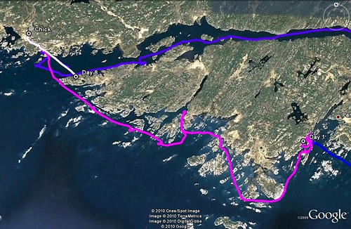
After leaving the park, we drove south towards the town of Killarney and after several kilometers turned left into a narrow road and in no time reached the Chikanishing Creek Access Point (called “the Chick”).
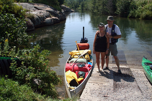
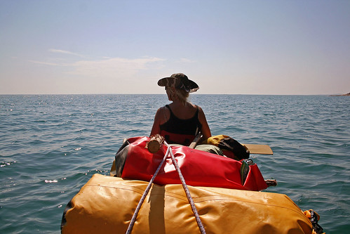
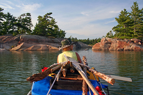
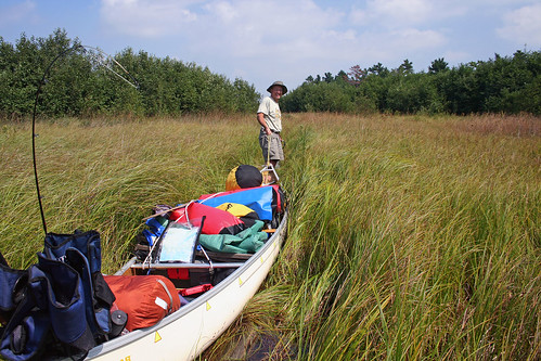
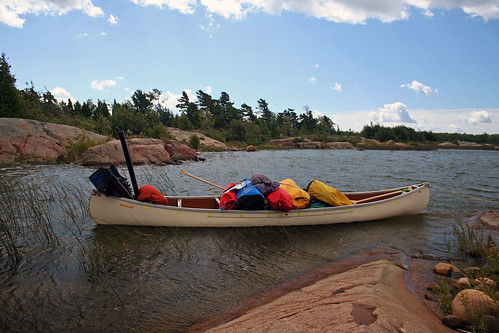
The parking lot was full of cars—and the whole place was buzzing with activity. The Chikanishing trailhead is located at this point, so lots of hikers were milling about. Some kayakers and canoeists were just coming in after splendid days on the water, others were just unloading their cars and putting canoes/kayaks on the water. There were also a number of kayaks and canoes stored near the boat ramp, probably dropped off by rental companies and amazingly left unlocked. We managed to drive to the ramp, launched the canoe, unpacked our stuff and quickly parked the car so that others could use the ramp. After 30 minutes our canoe was neatly packed. The quantity of our gear caught attention of some people, especially kayakers, who cannot take a third of what we had. I explained that we just wanted to show how NOT to pack a canoe! Well, I have to admit—I am not a light packer (and neither is Catherine). We want to travel in relative comfort thus we bring chairs, extra tarps, kitchen equipment, extra propane, extra safety equipment and of course, I always carry my cameras, tripods and fishing tackle.
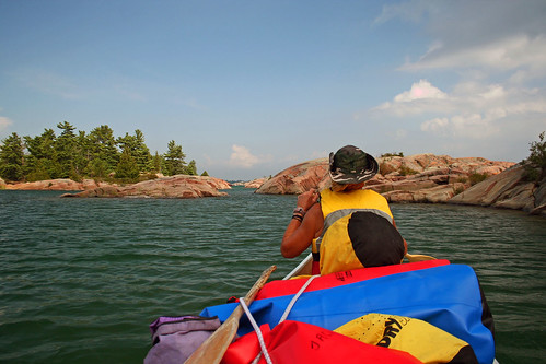
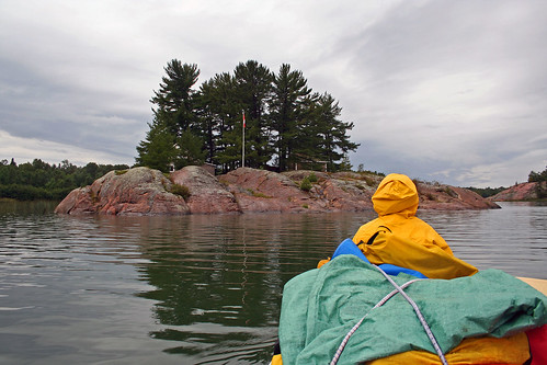
At 13:13 (i.e., 1:13 pm) we departed from the Chick and paddled on the Chikanishing Creek, passing a few kayaks, motor boats and canoes. We were surprised at the number of motor boat; actually surprised that they were allowed at the access point at all. A couple of minutes later majestic and imposing rocks came into view—and we entered the open waters of Georgian Bay! The area was stunning—there were a lot of islands with characteristic wind-swept pines, formed by western winds. Since prevailing winds are from the west, it is best to paddle around the island counterclockwise—that way the winds should ‘push’ you whilst you paddle on the exposed southern shoreline. On the left we passed South Point and now were paddling south of Philip Edward Island.
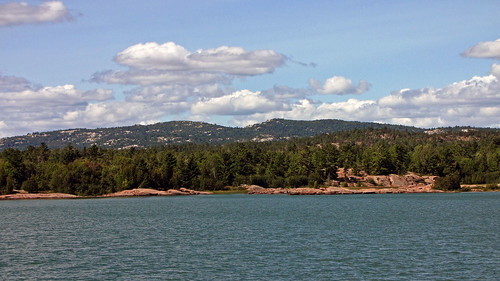
The weather was perfect—it was warm, sunny and the light easterly wind made it possible for us to paddle more on the open water. It was such an amazing feeling when we were paddling south and did not see the opposite shore—we felt as if we were paddling on the sea or ocean! And the clear azure colour made us almost want to double-check for saltwater. When we looked towards Killarney Park, we saw the distinctive ranges of ‘white mountains’ (La Cloche Mountains, mainly composed of quartzite, are one of the oldest mountain ranges on earth); I am sure one could be fooled into thinking it was snow!
The scenery was breathtaking; we maneuvered among the myriads of the barren islands, shoals and rocks, often had to paddle around rocks submerged just under the water. But let me diverge a little and go back 171 years in time...
In 1836 Anna Brownell Jameson (1794-1860), a British writer, arrived in Canada (Upper Canada) to join her husband who was soon to become the first Vice Chancellor of the Court of Equity in the province. She spent the next year travelling to such places as Niagara, Hamilton, Woodstock, London, the Talbot Country, Detroit, Mackinaw Island; she also traveled, mainly in a canoe, from Sault Ste. Marie to Toronto, visiting such places as Manitoulin Island and the site of town of Killarney, as well as along the shores of Georgian Bay, just south of Philip Edward Island and near the mouth of the French River. During her extensive travels she was thrown “into scenes and regions hitherto undescribed by any traveler and into relations with the Indian tribes such as few European women of refined and civilized habits have ever risked and none have recorder”. The result was her book titled “Winter Studies and Summer Rambles in Canada”, published after her return to England. This book gives a very vivid picture of the area, people and customs of the time.
While travelling south of Philip Edward Island towards the south, Anna Jameson also appreciated the beauty of the area:
“This day we had a most delightful run among hundreds of islands; sometimes darting through narrow rocky channels, so narrow that I could not see the water on either side of the canoe; and then emerging, we glided through vast fields of white water-lilies; it was perpetual variety, perpetual beauty, perpetual delight and enchantment, from hour to hour. The men sang their gay French songs, the other canoe joining in the chorus”.And later, she writes:
“We landed at sunset on a flat ledge of rock, free from bushes, which we avoided as much as possible for fear of mosquitoes and rattle-snakes; and while the men pitched the marquees and cooked supper, I walked and mused. I wish I could give you the least idea of the beauty of this evening; but while I try to put in words what was before me, the sense of its ineffable loveliness overpowers me now, even as it did then. (...) The lake lay weltering under the western sky like a bath of molten gold; the rocky islands which studded its surface were of a dense purple, except where their edges seemed fringed with fire. They assumed to the visionary eye, strange forms; some were like great horned beetles, some like turtles, some like crocodiles, and some like sleeping whales and winged fishes; the foliage upon them resembled dorsal fins, and sometimes tufts of feathers. Then, as the purple shadows came darkening from the east, the young crescent moon showed herself, flinging a paly splendor over the water. I remember standing on the shore, ‘my spirits as in a dream were all bound up’—overcome by such an intense feeling of the beautiful—such a deep adoration for the power that had created it.”Even though those words were written 171 years ago, the splendor and beauty of the area, as well as the emotions they stir have not changed.
In the south we saw several islands—the Foxes, which offer awesome scenery. They are very popular with especially with kayakers because reaching them requires paddling on the open waters of Georgian Bay for 2-3 km. Since the weather on Georgian Bay can be unpredictable, it may be sometimes difficult to get to them—or end up being stranded on them for several days, waiting for the weather to improve and the winds to subside. Initially, we were considering paddling to the Foxes as part of our trip; since the weather was ideal, it would be very easy to get there.
However, we decided not to go there at this time, but leave the Foxes as the destination for our next trip (yeah, we already made a decision to go there again!). We continued paddling east, enjoying the surroundings. We explored Winakaching Bay, later paddled more towards the south, on more open waters of Georgian Bay, even reaching East Fox Island, which is part of the northern part of the Foxes.
We paddled around Blockbuster Island—one big hilly rock, offering excellent viewpoints—and then paddled to West Desjardin Bay. It was dotted with islands, shoals and startling rock formations.
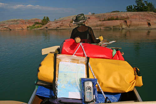
I have to add that I always carried my Garmin GPS unit with me—yet sometimes I did not exactly know where I was, because the topographical map only showed bigger islands—and due to the relatively low water level, the number of visible islands and rocks had greatly increased! I cannot imagine canoeing without GPS—navigation using the compass would be very tiresome and time consuming (although in case of this trip, we knew that we had to simply paddle east... and then north... and west—yet it was great to know where we were). I know that some purists do not use GPS, but I am certainly not one of them—it is my philosophy that by using GPS I have more time to relish the surrounding scenery and I do not have to constantly worry if I am lost.
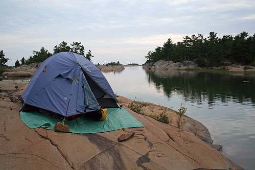
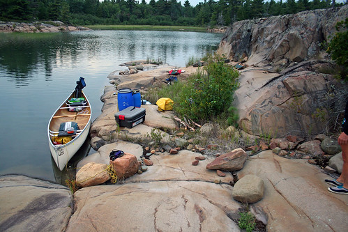
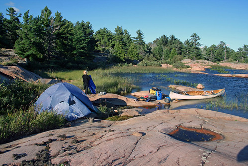
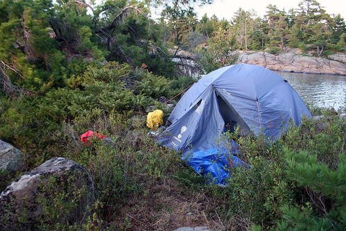
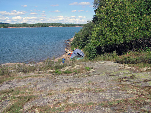
We passed Pig Island, paddled for a while among reddish rocks and on the west side of West Desjardin Bay we spotted an excellent campsite—it had a fire pit and was easily accessible. We decided to spend the first night here.
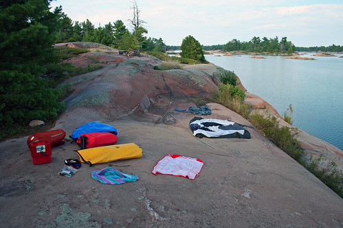
We unpacked our gear and I quickly set up the tent on a flat rock. The fire pit was located several meters up on a small hill, which also made a great viewpoint: we could see whole West Desjardin Bay and unfathomable waters of Georgian Bay. There were also a lot of scenic hills and rocks on the shore. Beside the tent there were five steel rings driven into the rock; probably over 100 years old, they were once used to hold the booms of logs or perhaps docking boats. Well, this seemingly isolated place was full of history! I do not even want to mention how many photos I took—luckily, my partner was very understanding and always willing to accommodate my mini photo session by stopping or paddling solo while I was ‘playing’ with my cameras or camcorder. Not long ago she bought a camera and often took photos as well. We had no problems finding firewood—some islands are barren and firewood must be brought there or scavenged along the way. Just in case, we did carry a little wood, enough for one campfire.
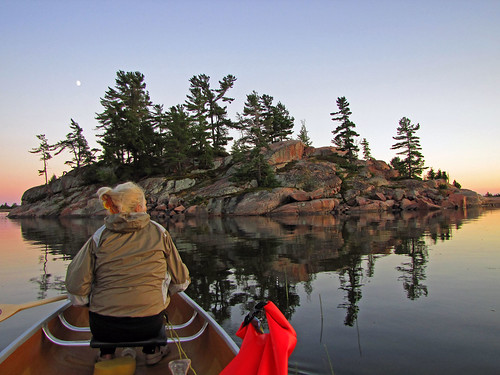
Around 9:00 pm, when it was getting dark, we got into the canoe and paddled around our campsite, often dodging rocks and maneuvering through narrow rocky channels and shoals. Paddling after sunset is very enjoyable, especially when the moon is full—there are no mosquitoes on the water, it is not very hot, humidity level decreases. It is a good idea to leave a candle or flashing flashlight on the shore—a few times we almost got lost while paddling at night—all those islands and rocks are so similar that it is easy to get lost during the day, let alone at night! At about 10:00 pm we unpacked our marinaded steaks, garlic and red sweet potatoes, got one bottle of red wine and hung the barrels containing our food on a tree. It was not very easy, but of course, one should do it every night due to bear activity. However, it is often very difficult, if not outright impossible, to find a suitable tree, with a strong branch (some appear to be strong, yet they quickly break) and the whole ‘hanging process’ takes a lot of time and effort. In general, bears try to avoid people and very few campers have had problems with bears—nevertheless, I had had bears visiting my campsite on three separate occasions. I also had a Bear Spray, which I always had handy; supposedly if used properly, it is 100% effective—but I would not like to ever test it!
After a few minutes we had the campfire going and one hour later we were having our dinner; considering that our lunch consisted of a Vegan Protein Shake, we were always glad to have dinner! Before going to bed I listened to the weather report (I brought with me a Marine Radio, a Ham Radio with weather channels and two small FSR radios with weather channels—as well as a regular AM/FM radio)—the forecast called for winds of 10 knots per hour, so we hoped the weather would be fine the next day. After 1:00 am we were sound asleep.
Day Two, August 14, 2010
Because it was the first day of our trip when we did not have to rush anywhere, we awoke at... 3:00 pm! Apparently we needed the rest; besides, the fresh air had a very soporific effect on us. The weather was great—sunny, warm, yet there was some wind. Although it was somehow late, we packed up and were on the water before five o’clock, ready to paddle on. Ignoring the wind and waves, we proceeded south of PEI, paddling on the exposed waters of Georgian Bay. Our fully loaded canoe had no problem with going against the waves. The scenery was stunning—we always saw new rock formations, some totally barren. We passed a few kayakers.
On one of such rocky a furry animal appeared, probably a marten; ignoring our presence, it went about vigorously eating a crayfish. Because the wind was increasing, instead of paddling around Silver Island from the south, we took the Silver Island Channel, which sheltered us from the wind. The we paddled to the south, towards the open water of Georgian Bay, on Big Rock Bay.
The only optional portage of this trip was located there and in case of strong winds, it would save us rounding Big Rock Point. Even though the waves were quite big, we never considered using the portage. On the left we saw some tents and kayaks; some people were standing on shore and staring at us. It quickly became apparent why: the more we proceeded towards the south, the windier and wavier it became. In addition, there were some submerged rocks, now exposed and whipped by the waves. As we already reached the point of no return as we paddled as strongly as possible. There were two big rocks—and plenty of whitecaps all over them; we had to paddle exactly between them. We had a very tough time making it through the gap, the canoe was often pushed towards the rocks and it took a lot of incessant paddling to steer it away from the rocks. Nevertheless, the canoe was quite stable and we were moving forwards; all this time we made sure it is positioned at 45-90 degrees towards the waves. Finally, we were between Big Rock Point and Red Crow Island and slowly started turning north. We had to continually watch for the waves which were often pushing us towards semi-submerged rocks; if we hit such rocks, it could have resulted in a serious damage to our canoe. On the other side of the Point we saw a tent and another group of people looking at us. Yet we made it! The more we paddled towards the north, the calmer it became. A couple of minutes later we were paddling on the still water—only the roars of waves hitting the rocks and whitecaps reminded us that the wind is still blowing!
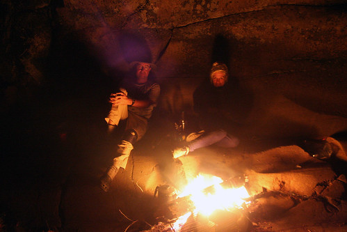
We paddled among very scenic rocks, inlets, shoals and narrow gaps and finally reached a nice camping site on an island, located just vis-à-vis the other end of the Big Rock Portage on the opposite shore. As always, we set up the tent on a flat rock and I built a small fire pit next to the steep rocky wall (when the water level is normal, most of the campsite is under the water).
Once we started the fire, we could analyze the day’s events. We realized we were quite lucky that we made it around Big Rock Point—after all, the portage was there for a good reason! In fact, Kevin Callan mentions in his book that this portage had been used for the past several hundred years by Native People and traders. We sat around the fire till very late, totally sheltered from the raging wind, which made a howling sound from afar. We did not hang the barrels—we could not really find any appropriate trees nearby—besides, it would have taken us a lot of time and effort.
So, we placed a few rocks on the cover so that we could hear if any animal were to overturn the barrel. We did not hang the barrels on our subsequent campsites either, mainly because of the lack of good trees—yet no animal (nor human) ever tried to get into the barrels.
Day Three, August 14, 2010
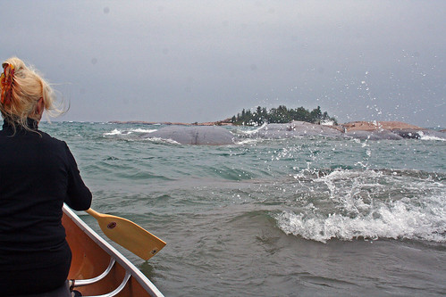
We were up just before noon as a group of kayakers was passing by—probably they were looking for the portage, but left after a couple of minutes. It was still windy, cloudy, even a little rainy. After breakfast we paddled towards Georgian Bay. Once we left the sheltered bays, the canoe started to go up and down on the waves; some of the waves were forming whitecaps. Catherine started to feel a little seasick.
We reached a group of rocks, which were being hit by waves which washed over them, producing spray—we had to continue paddling all the time to avoid being thrown into the rocks. I managed to get my cameras out and take several photos, but was ready to grip the paddle in case of problems. We stopped near the rock on which the kayakers camped yesterday and for almost one hour relished the awesome view—the boundless waters of Georgian Bay, the scattered islands and rocks in the bay and the unrelenting waves that kept hitting them.
Two kayakers appeared among those islands; we waved to them—they never ventured on the open waters, but stayed in the sheltered area. On our way back we visited a small bay, located just a hundred meters from our campsite. A (home made?) house boat was docked there, tied with ropes to the shore.
Perhaps the owner avoided property tax this way! Then we paddled by our campsite and towards Garbage Bay. It was quite charming, dotted with rocks... and suddenly, there was a pile of garbage or rather bygones from another decade on its shore! At least its name DID live up to its reputation! Half an hour later we paddled back to the campsite; finally, I could read some old newspapers, spent some time fishing (but it was too shallow and did not catch anything), listened to the radio and weather forecast.
We started the campfire at about 9:00 pm, had our traditional meal (still had marinaded steaks) and went to bed after one in the morning.
Day Four, August 15, 2010
I was up at 7:00 am—and I was so lucky, as it was very foggy! I grabbed all my cameras and camcorder and began taking photos and videos—and then went back to the tent, only to wake up again at noon. Catherine had suggested we romantically paddle in the mist, but there were lighting flashes around.
We swam a little, then had breakfast, packed up and exactly at 14:14:14 (i.e., 1:14:14 pm.) left the campsite. The forecast was not very promising—“Strong winds, up to 24 knots per hour”. For that reason we decided to keep as close to the shore as possible and take all the available channels—which, according to the map, should shelter us from the wind. Once we passed Garbage Bay, we hoped to take the channel between Bateman Island and PEI—yet the channel appeared to be very overgrown and shallow.
We got out of the canoe—Catherine was pulling the canoe, I was pushing it—but to no avail, because gradually the water totally disappeared and like it or not, we had to go back. The water level had gone down in the past years and thus some channels were not navigable, even for canoes. So, we paddled around Bateman Island—it turned out to be a very charming area and the many bays and islets sheltered us from the wind. There were a number of cottages and buildings on the south side of Bateman Island and on some adjacent islands—some of them were quite big and appeared to be part of some old community. We asked a couple sitting on the dock and they confirmed that they were indeed part of an old commercial center. Once we paddled around Bateman Island, we proceeded towards Cross Bay—the waves again became bigger and we had problems controlling our canoe; a motor boat with several people was passing by and everybody was looking at us as we were struggling with the waves—because we were paddling close to the shore, the waves, bouncing off the rocks, became augmented and the water became very turbulent. Sometimes the canoe positioned itself parallel to the waves, causing a hazardous ‘rocking effect’—both of us had to keep paddling very hard to right the canoe.
After a while we entered rocky ‘canyons’, sheltered from the wind and waves—it was one of the most enjoyable part of our journey! Finally we reached Bear Bay, took a short channel to Moose Bay and we were planning to take yet another channel to Deer Island Bay—but the latter turned out to be very overgrown with water grass. We did not know if we could make it and feared that we would have to paddle around the south side of Deer Island.
Despite the dense rushes there was enough water for the canoe to move, albeit very slowly and we made it to Deer Island Bay—while traversing this route, we caught plenty of spiders and other bugs which fell into our canoe. Deer Island Bay was the last bigger bay before Beaverstone Bay. According to the map, we were supposed to paddle south, then turn east—and either paddle through a passage between Hincks Island and PEI or between Hincks Island and Toad Island—yet the latter route was very exposed and windy. Upon entering Deer Island Bay, we immediately felt the power of the wind and waves; the farther south we paddled, the windier and wavier it got.
Our objective was to reach Hincks Island and camp there overnight; even though we saw the island on our left (several tents were already set up there), it was very difficult for us to reach it due to high waves—if we had turned left, we would have been paddling parallel to the waves, which was not advisable. So, we slowly paddled against the wind and waves and when we were far enough, we suddenly turned the canoe 180 degrees and paddled north. Tired, we were trying to find the passage between PEI and Hincks Island—it turned out that the passage was there, yet a narrow sandbar blocked us from entering it.
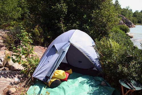
We paddled to that sandbar and decided to make our camp there. In spite of the strong wind, we set up our tent on the top of the nearby rocky hill, moved all our equipment behind the rock and then pushed our canoe over the sandbar and docked it in the passage, where it was sheltered from the wind.
Several hours later we wanted to check out if the passage is navigable and set out on a short canoe jaunt. The passage, although shallow, was perfectly navigable, as long as we watched for the submerged rocks, and quickly entered the big bay on the other side of the passage. The wind increased and after just a minute of paddling we realized that the waves had become much bigger in the past three hours. Nevertheless, we did not feel we were in any danger and even enjoyed this whole experience. Slowly, we paddled to the first rocks, which were incessantly hit by the waves, causing a lot of spray. I got out my camcorder and started videotaping... and then I spotted a wave in front of our canoe which was 2 times bigger than the others... Catherine cried, “Oh my God”, which I managed to videotape—and then I quickly put away the camcorder and we started to paddle back. At that very moment another wave, having the same size as the last one, appeared out of nowhere and tossed the canoe. We wanted to turn the canoe 180 degrees—which was risky, because being parallel to the waves could have been very perilous in such a weather. We waited for some time and when we thought everything was clear, started to turn the canoe, paddling very hard from the same side.
Unfortunately, another big, white-crested wave appeared ‘out of nowhere’ and reached us when the canoe was almost horizontally positioned to the waves. It lifted and tossed the canoe around, plenty of water got into the canoe through the gunwales—yet we did not flip! We kept paddling and finally righted the canoe towards the waves. Another wave caught up with us and raised the canoe—I had a feeling that an invisible giant grabbed it from behind—and pushed it powerfully forward with great force. Some water got into the canoe again, but we were still in control and still on the water! A couple of similar waves hit us from behind, but after a minute of hard paddling we were beyond their reach. Wet, yet happy, we got back to our campsite. It was a good lesson for us—Georgian Bay is indeed unpredictable when it comes to the weather!
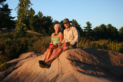
At 8:00 in the evening we sat on the rocks on the beach and observed the sunset and took photos. At that time one of the canoeists who was staying on Hincks Island came up to us. He wanted to check out if it was possible to navigate through the passage—we told him that yes, it was, we had just gone to check it out ourselves and had gotten more than we bargained for! His group of 6 canoeists was doing the same route we were and they were departing the next day in the morning. I also told him a story that Kevin Callan describes in his book—when he arrived at Hincks Island, he spotted a black bear just leaving; he waited for a while, pondering whether or not to stay or paddle on, but eventually liked the campsite so much that decided to stay. I also put to rest any fears he might had as a result of this story—I assured him that this bear must have been long gone from the island!
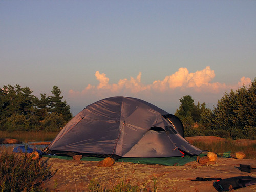
A couple of meters from the tent, at the bottom of the rock on which the tent stood, Catherine built a very innovative fire pit, made up of just two rocks—and one had already been there. She would like to claim being a purist at heart but will admit to being, well, lazy too. It was the last time we were going to grill our marinaded meat we brought from Toronto—it lasted for a long time! In the east we saw very distinct clouds, still lit by the setting sun—they were also lit by lighting (yet no sound was heard). Soon I started the fire and we sat till very late that night—our usual modus operands.
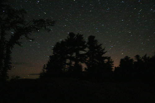
The sky was clear and dotted with stars; we also observed the Milky Way. The wind was increasing and before turning in, I had to tie it to more rock so that it would not be blown away. We went to sleep at 1:00 am.
Day Five, August 16, 2010
I got up at 3:30 am, or rather I was awaken by the blowing wind. The tent was bending and twisting and I was afraid it would not withstand such a strong wind. It also started to rain and we saw an occasional lighting. At 8:00 am we were awaken for the second time by our neighbours the canoeists, who were just paddling through the passage. The weather was clearly deteriorating—it was getting windier and kept raining. At 10:00 am a group of 4 kayakers appeared and also took the passage. When they left, we got out of the tent; the wind was so strong that we decided to flatten the tent for the time being and thus save it from the potential wind damage.
After breakfast we went to explore Hincks Island. Without a doubt the island was very picturesque, had plenty of trees, yet about half of the island constituted barren rock. Several trees, especially those exposed to the western wind, were uprooted and we could examine their root system. As the trees were falling, their roots, wrapped around big rocks, pulled the rocks and now they were still lodged in the roots. From the top of the island we saw the white mountains of Killarney Park and the turbulent water of Georgian Bay.
We walked to the east side of the island—that part of the island was quite barren—and reached the other shore. It was near that shore where we had those problems paddling yesterday.
Yet the wind was not as strong yesterday as it was today—I would not venture to paddle there today! We spent an hour sitting on the rock and observing the waves hitting the rocks. A medium motor boat traversed the choppy waters in a distance—it was tossed right and left, but kept moving forward.
After a while we went back to our campsite—it was so windy that at times it was difficult to stand on the top of the hill where our tent was (still flattened!). The great fire pit that Catherine built yesterday was now flooded by the water brought pushed by the wind and waves—as well as the waves were washing over the sandbar. I almost started laughing—yesterday I was thinking about setting up our tent on the sandbar! We moved our tent down the hill, just next to the now unusable fire pit—it was not a good spot, but at least it did provide some shelter from the wind and we did not have to worry that our tent would be blown away—after all, according to the news, the wind reached up to 60 km/h.
That evening we did not have a campfire because there was no fire pit available nearby and we did not want to set it up too far from the tent—even during the day it was difficult to walk on the steep, rough and sometimes slippery rocks. Again we were observing stars and meteors and followed satellites, crossing the sky. One of the satellites became very bright for a couple of seconds and then went back to normal. Most likely it had highly reflective parts that can produce dazzling flares when they catch the sunlight at the right angle—and apparently the Sun, the satellite and we formed the perfect angle. Somehow we got bored without the campfire and went to the tent and read aloud just before midnight. The crescent moon peeking through the tent window was mesmerizing.
Day Six, August 17, 2010
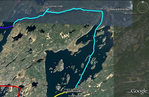
We were up at 8:00 am, full of hope that the weather would cooperate and will let us paddle for a while. At 10:00 we were packed and on the water. It was still windy, yet we had a feeling it had subsided somehow. After paddling through the passage we got on the open water. We wanted to paddle to Beaverstone Bay, which was the eastern border of PEI and then, keeping close to the western shore (sheltered from the western wind), eventually reach Collins Inlet. Unfortunately, just minutes later we felt that the waves were still too big; perhaps we could have made it to Beaverstone Bay, but we did not want to take any risks with the full canoe.
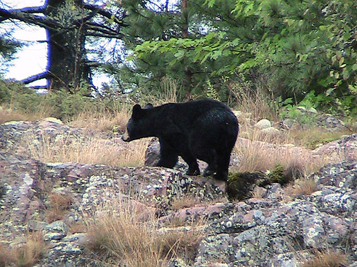
We ended up in a small bay just north of the passage—and then we saw a black bear on a rock afar, who was looking at us for a while and then darted to the forest. So, it was very close to our last campsite! I am sure that bears see us very often when we are camping or canoeing—but since they are not in general looking for an interaction with humans, they disappear before we can see them. Besides, a couple of times during this trip I heard some noises at night, like breaking boughs—most likely it was bears, because no other animals are so noisy at night.
Ten minutes later we entered a small bay and decided to wait out there, hoping that the weather would improve. Yet the strong wind blew all the time... We did not see any canoes or kayaks; only twice spotted motorboats. Catherine went for a hike and apparently saw a relatively big snake—it was either the Fox Snake or the only venomous snake in Ontario, the Eastern Massasauga Rattlesnake. Both are similar in appearance, yet the latter has a rattle which he uses to warn off potential predators.
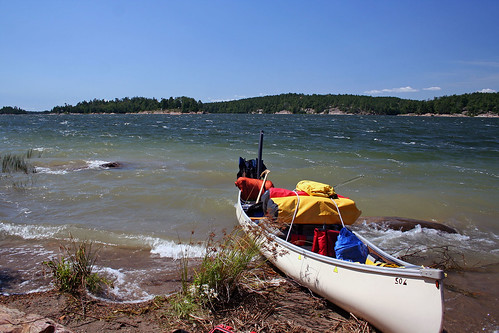
At 4:00 pm we thought that the weather got better and we continued our journey. A few minutes of paddling and we reached Beaverstone Bay—it was relatively calm and instead of paddling along the western shores, we decided to cross Beaverstone Bay across, which would shorten our trip. We paddled without any problems for about 1.5 km.; when we were approaching Barto Island, the wind again increased and whitecaps appeared. As we were near Two Pines Island, I saw a big waves appearing just behind the canoe—similar to those like two days ago! Because the wind blew from behind, our canoe, propelled by our hard paddling and strong wind, reached speeds of 9 km/h (usually our speed is between 4 and 6 km/h). At one point I considered camping on this island (I had no idea if the island was private), but the canoe was cruising so fast that we swiftly passed it—and now were coming to the eastern shore of Beaverstone Bay. Now we had another problem: all this shore was an Indian Reserve, off limits for camping, yet we had no choice.
We got into a small bay and for a while waited for the weather to change. The bay where we parked our canoe was very sheltered, yet had steep hillsides—and the wind was so strong that I had to be careful not to be knocked off my feet. Several meters up that ridge we found a somewhat better spot for the tent and in order to facilitate the unloading of the canoe, we paddled the canoe there.
Our future tent site was very small and it had an old fire pit in the middle—we had to remove all the rocks and sticks and our tent barely fit there. In the evening we sat on the rock and admired the sunset. I build a small fire pit, completely sheltered from the wind so that at least we could enjoy a campfire. We went to bed quite early because we were planning to get up at 5:00 am.
Day Seven, August 18, 2010
Up at 6:00 am—the weather was great, no wind whatsoever—what a difference! After less than 2 hours we were on the water, paddling on Beaverstone Bay. Two big motorboats passed us, but otherwise we did not see any other boats or people. There were cottages of most of the islands. In no time we reached the northern side of the bay, where a number of buoys warned about low water level. We turned left and got into Collins Inlet, created as a result of tectonic fault.
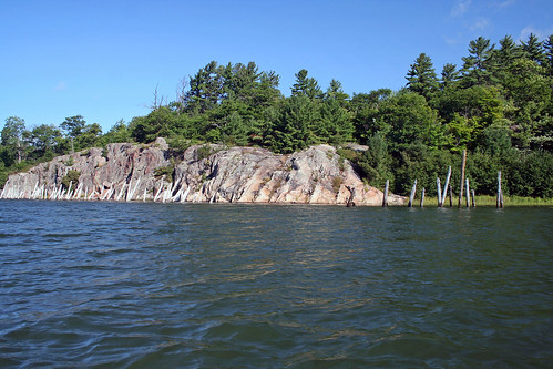
The scenery was still very nice, yet very different from that south of PEI. Whereas that area abounded in excellent campsites, here the situation was quite the opposite: it was very difficult to find any campsite—the shores were densely forested, often had tall, majestic, jagged and inaccessible rocky walls. The north side of Collins Inlet was the Indian Reserve. After paddling for three kilometers later we reached the former town/settlement of Collins Inlet, currently the site of Mahzenazing River Lodge. Collin Inlet was established in 1868—the mill prospered and huge log booms were a common site. There was a hotel, several private homes, a school and a company store. Plenty of ships—schooners and steamers—visited the town and at one point the population exceeded 200 inhabitants. In the beginning of 20th century the mill was destroyed by fire and the town started to decline. Many of the building burned down, others collapsed and were engulfed by the forest.
Today a few remaining buildings are part of the lodge; still visible are logs sticking out of the water which supported the dock—and at the entrance to bay leading to the lodge two steel rings are entrenched in the rock, remaining about the old, good days gone by. There was another fishing lodge on just the opposite shore of Collins Inlet, more modern and buzzing with activity.
At one point Collins Inlet widens and then becomes part of Mill Lake—only to continue soon after its course towards west. We expected to explore Mill Lake and find a nice campsite there. Yet, we were out of luck again: when we were reaching Mill Lake, the wind started to blow once more! This time we did not have too many problems with the waves—after all, it was not Georgian Bay anymore—yet the wind was so strong that when we entered Mill Lake, we barely moved forward despite paddling very hard. It made no sense to paddle any further and we got to the shore, vis-à-vis the entrance to Collin Inlet on the opposite shore of the lake.
The site appeared to be quite nice—but not for camping: we could not even find a few square meters of flat rock or land to set up the tent, there were jagged and sharp rocks, plenty of crevices and we had to be careful while walking not to slip. We kept waiting for several hours, waiting for the weather to get better (again!).
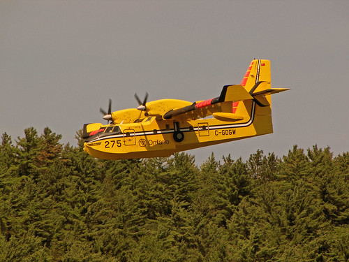
Several boats were entering and exiting Collins Inlet, as well as we saw a yellow plane, which started to circle above us and finally descended and almost landed on the water, yet quickly took off. Soon it did the same thing—and repeated this maneuver three more times. We though it was training—it was only later that we found out it was a water bomber, putting out a fire somewhere in the area!
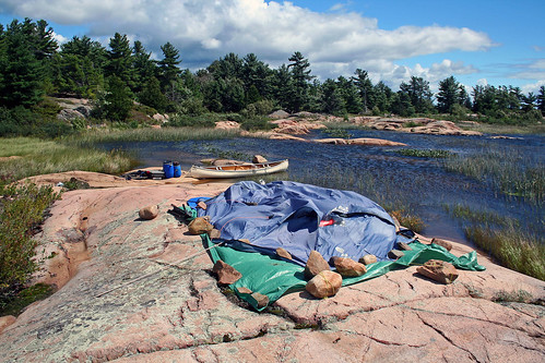
Since the wind kept blowing, we had no choice but to spend the night there. The only spot that could be considered for the tent was located just next to the water—normally this place was under the water, but due to low water levels it was exposed.
It was less than one meter from the lake and we were a little afraid that if the wind picked up, the waves might eventually reach the tent. We spent 30 minutes, clearing the rocks (one was about 60 kg. and we had to roll it away), weeds, stones and sticks. Finally I made the tent fit—its two poles were supported against the sloping rocky ledge, the other two were inside the bushes.
Yet it was possible to comfortably sleep inside! We also wanted to have a fire that night—because we could not find any sheltered spot, I built an elaborate fire pit between two rock ridges, using plenty of rocks.
Since firewood was plentiful, in no time we had a very nice fire! Well, once the water level increases, our fire pit and campsite will disappear under the water... We turned in quite early since we wanted to be up as early in the morning as possible.
Day Eight, August 19, 2010
Amazingly, we were up at 5:30 am and started packing when it was still dark. There was no wind. We were on the water before 7:00 am and paddled towards the entrance to the second leg of Collins Inlet. It started to rain a little, but we just ignored it. Both shores of Collins Inlet were made of steep walls of reddish rock—and finding a campsite was impossible!
Finally it stated to pour and we had to don our raingear, yet paddled on, despite lighting and thunder. At one point we paddled very close to the rock, taking advantage of a small overhang. Indeed, it did protect us from rain—yet soon the water started dripping from the top of the rock and flowing directly into our canoe! Not a very good idea! During our stay I cast a few times and at last caught my only fish—a small pike—which I soon released. As we got cold, we decided to keep paddling despite the weather. We saw some sporadic cottages on the shores of Collins Inlet, but did not see any people or boats—however, Collins Inlet can be a very busy waterway! After paddling for about 10 km., we reached some small islands—Turning Island and Bell Island.
Just past Bell Island there is a narrows and before the narrows, on our left, was a small bay—and we spotted a bear walking on its shores! We approached closer to the shore, but he ignored us and went about his business, i.e., turning over rocks and looking for food. We observed him for about 5 minutes until it disappeared behind the hill.
We paddled through the narrows and 15 minutes later we reached South Point Island—the same island we passed in the beginning of our trip. We decided to make our last campsite on that island.
There was a nice campsite just vis-à-vis the entrance to the Chikanishing Creek on the opposite side of Collins Inlet. I set up the tent right on the beach, close to the water and the canoe, in order not to carry our gear too far; the fire pit was already made on the top of the rock. I noticed that there were two dry places on the sand—after examining them closely, I concluded that two kayakers must have been camping on this very campsite and they had just left before our arrival!
Behind the fire pit, in the forest, we found a couple of nice campsites (one was quite dry) that could accommodate many tents. Soon the sun came out and we put our wet clothes out on the rock to dry. Catherine made hot soup and then we went to the tent—we slept from noon till 3:00 pm. Once we were up, we packed up some of our stuff and paddled to our car—since we wanted to visit the town of Killarney. It took us less than 30 minutes to reach the Chick; after chaining the canoe to the dock, we quickly drove to Killarney. Our first stop was the LCBO store where we chatted with the store manager about life in Killarney nowadays and before the road was built. She also said that the recent winds were strong even by the Killarney standards!
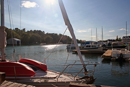
Then we went to the famous restaurant Herbert Fisheries—sometimes lineups are very long! We bough four pieces of fish and French fries ($13); as we were having them, we were observing boats in the Killarney Channel and thinking about its interesting history.
Because of its natural channel between Killarney Island and the mainland—and because on was located on the main canoe route to the west—it was known and used by both Natives and white explorers as a shelter; such men as LaSalle, Marquette, Etienne Brule as well as many fur trades and explored passed through the channel. That is why Killarney’s earliest name, in the Ojibwa language, was Shebahonaning, meaning “safe canoe passage”. In 1820 Etienne Augustin de la Morandiere established a small trading post there. In 1854 a post office was opened. The town was only accessible by water—and later by air—until 1962, when the present highway no. 637 was built. In August, 1837, during her canoe journey from Sault Ste. Marie to Toronto, In 1837 the aforementioned Anna B. Jameson passed through the narrow channel between George and the mainland, where the present day town of Killarney is located. This is how she describes this event:
“About sunset, we came to the hut of a fur-trader, whose name I think, was Lemorondiere. It was on the shore of a beautiful channel running between the mainland and a large island. On a neighboring point, Wai,sow,win,de,bay (the Yellow-head) and his people were building their wigwams for the night. The appearance was most picturesque, particularly when the camp fires were lighted and the night came on.”And so 171 years later we were now sitting on the shores of this channel and enjoying its beauty!
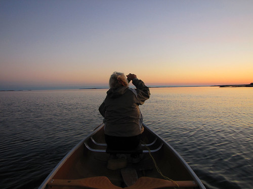
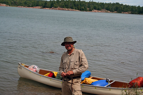
There were two sailing boats docked near the restaurant; once sailed from Germany, the other one was from Canada, yet not long ago sailed to Cuba. Around 8:00 pm we left Killarney and went back to the Chick to our canoe. Even though it was past sunset and getting dark, one young gentleman with a dog arrived, with a canoe on the roof of his car and was about to embark on a trip.
Once we left the mouth of the creek, we paddled for a while on open waters of Georgian Bay, admiring the amazing colors that still lingered on the water. There was no wind and we felt like paddling on! After a few minutes we saw the canoeist with the dog emerging from the creek.
Since it was quite dark, we asked him if perhaps he would like to stay on our campsite—but he said he loved canoeing at this time of the day and if the weather remained good, he could keep paddling the whole night—and paddled towards the Foxes. It was pitch dark when we arrived at our campsite and in no time started our last campfire of the trip—even though I am not too keen on beer, I truly enjoyed the can of still cold “Zywiec” beer I had bought in Killarney!
Day Nine, August 20, 2010
We packed our stuff for the last time and paddled straight to the Chick. The place was a beehive of activity: canoeists and kayakers coming and going, loading and unloading—plus a couple of people were trying to use the ramp to launch their motorboat. Catherine quickly brought the car and parked it very close to the boat ramp and we quickly loaded our gear, put the canoe on the roof and drove away in order not to block the access to the water.
Let me now make a few comments about our new canoe. It passed its test with flying colors—it turned out to be very stable and very roomy—and not every canoe is like that: some time in May or June we rented a canoe which was slightly smaller. Each time we were getting into it or paddling it, we had a feeling it would tip over—we had to warn each other before making any startling movements. We do not have any such problems now! We thought that the trade-off for its better stability, size and roominess would be in its slower speed—yet I believe this is not the case: I often measure our speed using my GPS and I have to say that this canoe is in fact faster than the smaller and tipper ones! Considering that we paid several hundred dollars more for this canoe than the cost of smaller used rental canoes—many of them 4-5 years old, with patched-up holes, plenty of scratches and in some cases requiring maintenance before launching them—I think it was a great buy. Besides... it costs from $35 to $45 per day to rent a canoe, so in just the past month the realized savings amounted to close to half of the price we paid for the canoe.
Once the canoe was firmly strapped to the roof, we drove to the town of Killarney—yet on our way there we stopped at the local garbage dump which is frequented by black bears. We did see several bears, but the dump was closing now and we had to leave. We drove to Killarney and again went to the Herbert Fisheries Restaurant; I bough a few pieces of smoked fish and Catherine bough another fish and chips dinner.
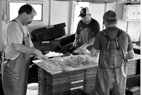
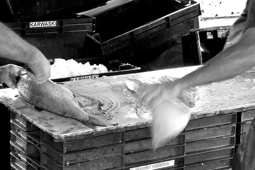
I was also told that the fishermen were just cleaning fish on the fishing boat docked behind the store, so I ran there and was able to take a lot of photos and videos as well chatted with them, they were really nice guys.
I said that I would be willing to work there for a day to learn how to fillet fish! Once they were finished, we again sat near the channel and were watching passing boats and eating delicious fish.
Later we went to Pitfield’s, a well-known store that carries some food and then visited the old prison, with three cells, which used to hold local drunks—now it was a store carrying plenty of needful things. I chatted with the owner who talked about local hunting, fishing and life before the highway. He said a lot of tourists from the USA fly here (yes, Killarney has an airstrip) and then go fishing, hunting, boating and stay in one of the local hotels.
After leaving the town of Killarney, we dropped to Killarney Park where took a hot shower and changed our clothes—it was a very good idea, I felt as if I lost 10 pounds! The park was of course full again—I was glad we stayed on that island the previous night and not in the park. Refreshed and rested, we were ready to drive back to Toronto—but before we stopped in the Hungry Bear Restaurant near highway 69, just north of the French Bridge.
I had visited this restaurant for the fist time in 1995, right after coming back from my first canoe trip on the French River—and from then on I visited it each time I was in the area. It serves excellent grilled hamburgers which taste so good, especially after a week spent canoeing! The drive home was a breeze—we stopped a few times to check the canoe, but had no problems with it. We reached Toronto before midnight.
It was my most interesting canoe trip this season and despite the weather, it was a success. The adventures related to the strong winds and high waves and the necessity of spending a few nights on not-so-comfortable, campsites (I do not event want to mention the rain!) only augmented our impressions and added diversity to our trip—as well as we acquired valuable experience which, I am sure, will come really handy in our future trips; after all, we have already started planning our canoe trip to the Foxes!
More photos from this trip here: http://www.flickr.com/photos/jack_1962/sets/72157624843531638