Blog po polsku/Polish Blog: http://ontario-nature-polish.blogspot.com/2011/07/na-kanu-w-killarney-provincial-park.html
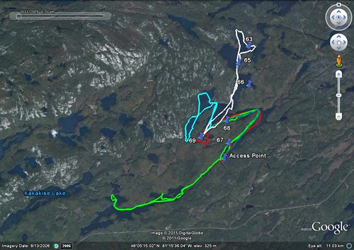
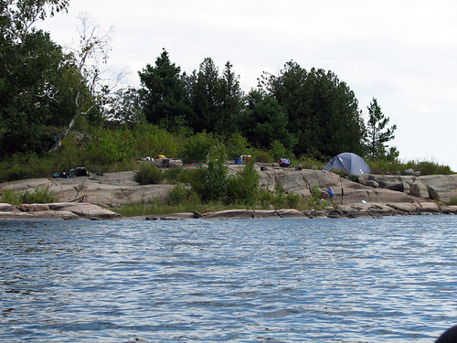
After poring for a few hours over the Killarney map, we decided to reserve a campsite on Johnnie Lake. This lake did not seem to have any portages and it also was adjacent to Carlyle Lake, another long and portage-free lake. When we called the park, we were quite lucky—there was only one campsite left in the park and it happened to be on Johnnie Lake! It's a very popular park and most of campsites are gone within days, if not hours. By the way, according to the map, there were several campsites all over the lake and we were free to camp on any one of them which was not occupied. After studying the Google satellite map, I noticed that campsite number 69 was located at the cul-de-sac of the lake, vis-à-vis an island and next to a small, weeded bay. Whereas we were not sure if this campsite was otherwise nice—or vacant—we certainly were thinking about setting our camp there.
We left Toronto in two separate cars since Catherine was planning to afterwards drive to the USA via Sault Ste Marie and the famous Mackinac Bridge. It was of course a long drive from Toronto, but I always enjoy it: the traffic is usually very light and the surrounding typical Canadian Shield rugged scenery make it a pleasant experience. By the way, we stopped for two nights in Oastler Lake Park on site 143, near a big rock outcropping beside the lake and paddled for a few hours on Oastler Lake the next day.
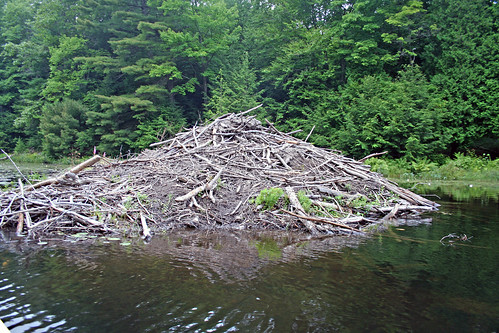
After pitching the tent, we went paddling around the island. A large beaver lodge rose from the water, adjacent to the other side of the island and apparently the beavers frequented the island on a regular basis, as we spotted a beaten path leading to the water. Later we saw several beavers swimming around, but mostly heard them in the evening and at night when they were slapping their flat tails against the water.
It was slowly getting dark and we were still on the water, enjoying the silence, interrupted only by nature's natural sounds—until several canoeists in two canoes entered the area and shouted to us if there were any campsites available around. Since there were none, they paddled back, visibly upset, as one of the teen girls started swearing profoundly, not realizing that her voice was carrying across the water, right to our unsuspecting ears!
Over the next several days we paddled all over Johnnie Lake, as well as Catherine portaged (for the first time in her life) the canoe over a 100 meter portage to a small and scenic lake called Ruth Roy Lake, just north of Johnnie Lake.
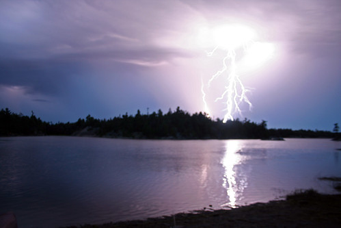
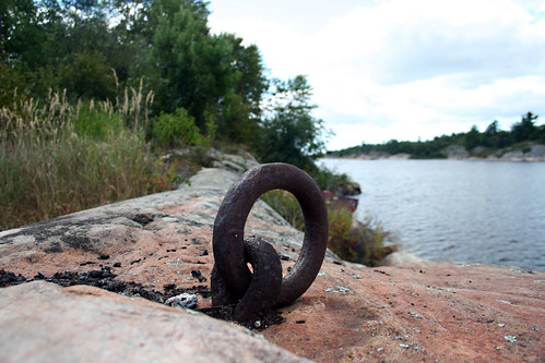
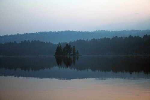
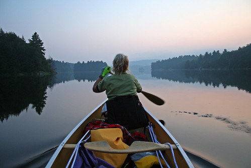
There was at least one campsite, occupied by a couple—they made a great choice, picking this lake! Another day we paddled towards the access point (where our car was parked) and onto Carlyle Lake. The first part of the lake was quite narrow, weeded and dotted with beaver lodges—yet one of them was inhabited by a family of otters. Upon seeing us, the otters kept disappearing into the lodge's numerous cracks and crannies and appearing in other openings, as well as started making not-so friendly sounds, presumably to scare us off. We paddled on and soon reached a very interesting campsite, located next to a big, moss covered rock; it was dark, quiet and very mysterious! We took a right turn, paddled through a short strait and entered a small bay just south of Terry Lake. A British family was camping there and we briefly spoke to them. As we paddled around the bay, we heard a small fall or rapids near Terry Lake. Since it was getting late, we turned back, yet managed to quickly go ashore and examine a few campsites. When we finally reached the “180 degree turn” on Johnnie Lake, it was quite dark and foggy and I took a number of photographs—one of them even won an award in my photo club!
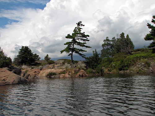
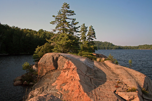
I could probably go on and on describing the utmost beauty of Killarney Park, but just let me say that its numerous gorgeous lakes and unique white mountains (La Cloche), combined with many long hiking and canoeing routes, make it a true gem not only in Ontario, but probably in North America. However, in order to explore it, one must spend at least one week hiking—or better yet, canoeing on its many long routes. Unfortunately, the vast majority of canoe routes require extensive portaging, sometimes of over one kilometer. Nevertheless, there are a few shorter routes which offer great portage-less paddling opportunities.
We left Toronto in two separate cars since Catherine was planning to afterwards drive to the USA via Sault Ste Marie and the famous Mackinac Bridge. It was of course a long drive from Toronto, but I always enjoy it: the traffic is usually very light and the surrounding typical Canadian Shield rugged scenery make it a pleasant experience. By the way, we stopped for two nights in Oastler Lake Park on site 143, near a big rock outcropping beside the lake and paddled for a few hours on Oastler Lake the next day.
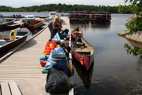
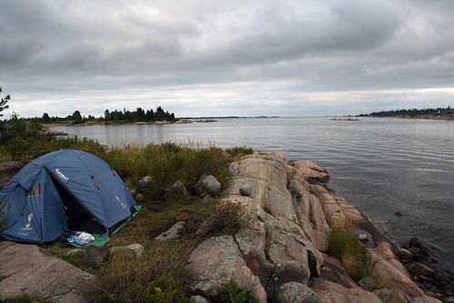
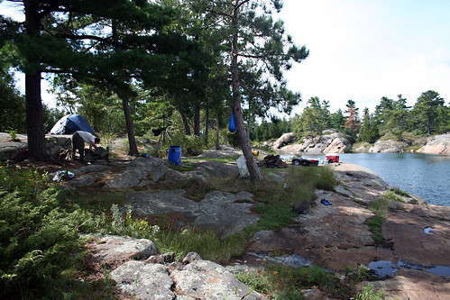
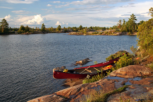
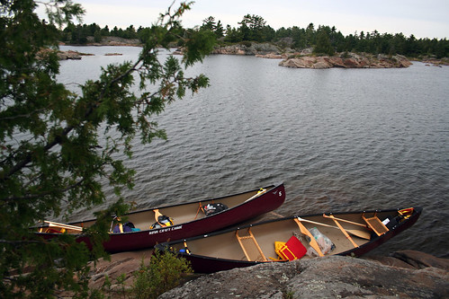
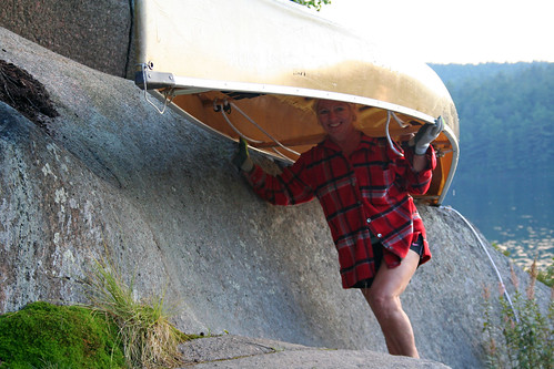
Once we reached the park, we had to drive to the park office to pick up our campsite and parking permits, then we drove back on road 637, turned left on unpaved road and soon arrived at the Johnnie Lake parking lot. Our canoe (which we had earlier booked and paid for) was waiting for us. Some fishermen who were departing warned us against the swampy site at the cul de sac bay... we later discovered was site 69... ours! We got on the water and started paddling. There were a few cottages on the right and we saw the first campsite on our left. After about 30 minutes we made a sharp left 180° turn and kept paddling towards the end of the lake. The area was very picturesque, dotted with a number of islands, plenty of bays and rocky shores. Having passed a small cottage on an island, we finally reached our campsite number 69. Indeed, it was very similar to what we imagined based on the Google satellite map: it was in the forest, had a nice rocky shore and faced the island we had seen on the map—in a nutshell, it was an excellent site!
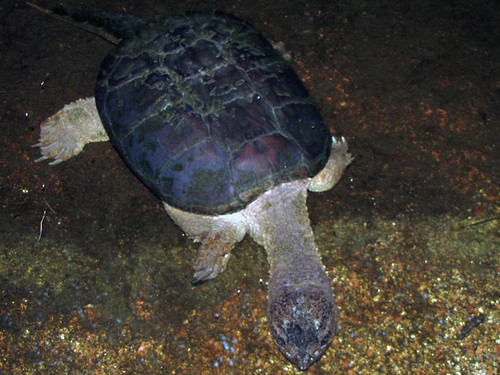
Once back at the campsite, I was trying my luck in fishing, yet I knew that lakes in Killarney did not have too many fish, the result of years of acid rain, caused by the smelters in the Sudbury area (that rain also destroyed plenty of trees). Strangely, the water was crystal clear. Indeed, I caught a few catfish, but they were too small for the frying pan! At one point I bent and was washing hands in the lake when I saw a HUGE snapping turtle floating just a meter or so away and slowly swimming towards me! But it was not all—there were two other snapping turtles in the water! Well, I had been used to raccoons usually visiting our campsites every night, hoping to steal anything edible, but it was the first time big snapping turtles decided to emulate their ground friends and approach tourists' campsites from the water! Soon the turtles were enjoying the catfish, indifferent to my videotaping them and using a strong flashlight. The turtles paid us regular evening visits and we enjoyed watching them. With their tough, leader-like skin, big paws, long and sharp claws, hard shell, powerful mouth and long tail, they looked like creatures from the Jurassic Park!
Here I would like to mention that in 2013 Catherine, I and
several of our friends camped on that site where the British family was camping
(http://ontario-nature.blogspot.com/2013/12/killarney-provincial-park-ontario.html).
Also, in 2014 (http://ontario-nature.blogspot.com/2015/10/killarney-provincial-park.html)
and then in 2017 (http://ontario-nature.blogspot.com/2018/08/car-camping-trip-to-killbear-killarney.html),
we camped on the campsite very close to the small falls/rapids, which was
located between Carlyle and Terry Lakes.
I have to mention another quite amusing, almost mystifying thing that we experienced during our trip. After setting up our camp the first day, we packed up our canoe with the usual stuff—cameras, rain gear, fishing equipment, tripods, binoculars, GPS unit and the like—and as we were about to depart, we clearly HEARD IT: absolutely eerie sounds, as if a child were slowly practicing a cello or a similar instrument... it was the type of music often heard in horror movies! We were almost certain there was nobody else around, yet the sound was so distinct that we started to apprehensively look around, trying to find the culprit who produced the tunes—but to no avail! While paddling the next day on the other side of Johnnie Lake, we heard it again—it was not as pronounced as before, but still clearly discernible, as if lazily flowing from afar, filling the air with subtle and mysterious tunes. Because both of us heard it, we presumed it was not our imagination (unless we fell victims to a mass imagination...). So, at one point we asked a camping family if they heard the sound... and then we posed the same question to another lonely camper. In both cases they said they did not hear anything; judging upon the looks on their faces, I do not even want to speculate what they REALLY THOUGHT about us! We kept hearing this inexplicable music on and off till the end of the trip and we did not manage to figure out its source. It was only the next year when we finally deciphered this enigma: it was my fishing rod's line, whipped by the wind, that acted like a harp and created those amazing sounds! Well, another Killarney mystery solved!
More photos from this trip: http://www.flickr.com/photos/jack_1962/sets/72157622560580991
Blog po polsku/Polish Blog: http://ontario-nature-polish.blogspot.com/2011/07/na-kanu-w-killarney-provincial-park.html