Day One, August 19, 2008: Paddling time: 3 hours 38 minutes. Trip Length: 14.3 km.
After a pleasant drive from Toronto and traditional lunch in the Hungry Bear Restaurant on highway 69, we drove to Hartley Bay House & Marina. The main office is located just meters from train tracks—there are a lot of trains passing through, almost all freight trains, but none stops there.
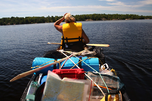
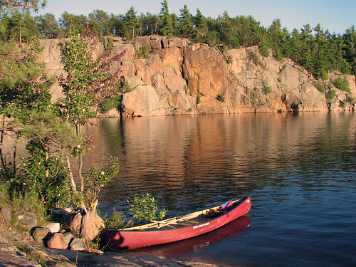
After getting park permits, renting a canoe, unloading our car and having it parked (yes, this place does provide a valet service!), we loaded our canoe and commenced our journey. The weather was nice and the wind barely noticeable. Once we reached Wanapitei Bay, we headed south and turned right into the Western Channel. To our right we passed Atwood Island, Dead Dog Island, Little Pig Island and finally paddled in the channel between King’s Island and Pig Island. There were a couple of campsites available, but since our plan was to stay on the same campsite for three nights, we hoped to get something more scenic. Eventually, we entered into a nice bay between Pig Island, King’s Island and Dispute Islands, with a spectacular rock that resembled the famous Mazinaw Rock at Bon Echo Provincial Park. According to the map (and my reliable GPS) site # 703 (N46 01 12.0 W80 54 17.8) was supposed to be located just opposite the rock. Well, a camping site was there, all right, but we could not see any ‘official’ sign.

Eventually we decided to disembark and check the site out. It was quite rocky, with many fallen trees and even an attached ‘washroom’ marker. As it turned out, the campsite sign was affixed to a tree—which had apparently been felled by strong winds. In no time we had the tent up and fire going. In the evening took the canoe and went fishing; in less than one hour managed to catch a pike, which we grilled over the fire, as well as I caught a catfish later on. It took me at least 30 minutes to clean & skin it, but it made excellent breakfast next day!). Just in case, we hanged our food on a rope spread between two trees, yet we never had problems with any animals, be it black bears or raccoons. Amazingly, mosquitoes were almost nonexistent. Now and then we saw a motorboat, but they were quite far from us. There were other campers staying on campsite # 702, just across the channel (700 m. from us) as we saw their faint campfire at night.
Day Two, August 20, 2008: Paddling time: 5 hours 31 minutes. Trip Length: 18.7 km.

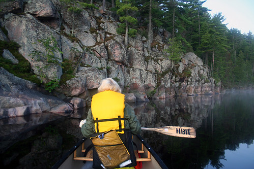
I was up after 06:00 am to take photographs of the mist coming off the water, it was really amazing! After catfish breakfast we decided to paddle to the Old Voyageur Channel—the route traditionally used by the Voyageurs in the 18 and 19 century. This is also the route described by many explorers, including Alexander Mackenzie over 200 years ago. We passed Crombie Bay and proceeded west, the route was straightforward, we encountered some head wind, which made paddling somehow difficult.
A couple of motorboats passed by, otherwise we hardly saw any other people. Had lunch on campsite # 709 (very spacious). Just over 1 km. later the Western Channel splits into four different channels and even with the GPS we had some problems finding the correct route—a lot of paddlers get confused and lost in the maze of almost identically looking rocks, channels and inlets. The Old Voyageur Channel turned out to be rather narrow and very pretty, made up of typical rocks for that area. After paddling for about 700 meters, we encountered the first rapids which required a short portage. Presumably the rapids were “La Petite Faucille”, also mentioned by Mackenzie, but I am still not sure. We felt like portaging and paddling on, but we had been told that once we pass the rapids, we reach the point of no return and have to continue down to Georgian Bay—not something we were prepared to do! So, after taking several photographs and enjoying the surrounding scenery, we turned back and in a couple of hours were at our campsite. Later that day I did some solo canoeing and managed to catch another pike.
Day Three, August 21, 2008: Paddling time: 4 hours 20 minutes. Trip Length: 9.6 km.
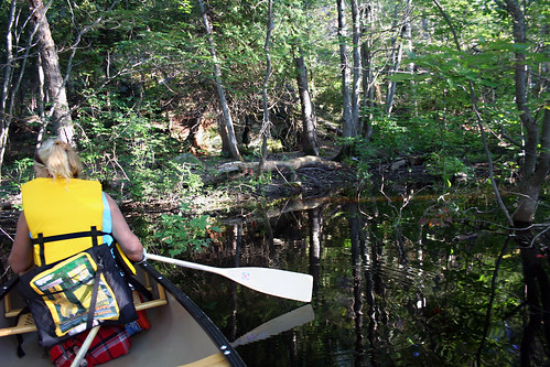
It was a little windy, so we decided to take it easy. However, we were on the water just before six in the morning and paddled up through a channel to Eagle’s Nest. Again the mist was coming off the water which created a typical ‘postcard’ view of the lake. We paddled next to a beaver lodge and saw a beaver swimming around. After reaching a small bay, we saw another lake, yet its water level was about 70 cm. higher than that of ours due to a strong beaver dam—and we were too lazy to carry over the canoe. After paddling for another 30 minutes, we returned to our campsite. In the evening we again canoed the same route. Since we were told the water level was very high at that time, a lot of trees’ trunks were under the water, so it felt as if we were canoeing in Florida’s Everglades or the Okefenokee Swamp in Georgia. Finally, we reached a blind bay with a very interesting vertical rock. I again decided to try my luck in fishing and in no time caught a pike. Since it was getting dark, we started paddling back, at one point almost got lost, yet soon reached our campsite and started a campfire fire.
Day Four, August 22, 2008: Paddling time: 4 hours 31 minutes. Trip Length: 14.2 km.
Our last day… we altered our route back home and paddled through a channel (Eagle’s Nest) and then north of Pig Island, Little Pig Island, Dead Dog Island and Attwood Island. Once we left the Western Channel and turned north, we saw number of campsite along the shore, some were occupied. We stopped on one of the islands on Wanapitei Bay and in less than 20 minutes I collected about 1 kg. of wild edible mushrooms. We reached Hartley Bay House and Marina at 05:40 pm, paid for the parking and canoe rentals and were on our way back to Toronto (almost 380 km.). On our way we stopped in Britt, a small town. Years ago it had a train station and big port, now it’s mainly tourists and recreational boaters who use the inlet—the train does not stop here anymore! After ice cream and coffee we were back on highway 69, then soon reached the 400 and arrived in Toronto past midnight.
More photos from this trip here: http://www.flickr.com/photos/jack_1962/sets/72157607383831003/